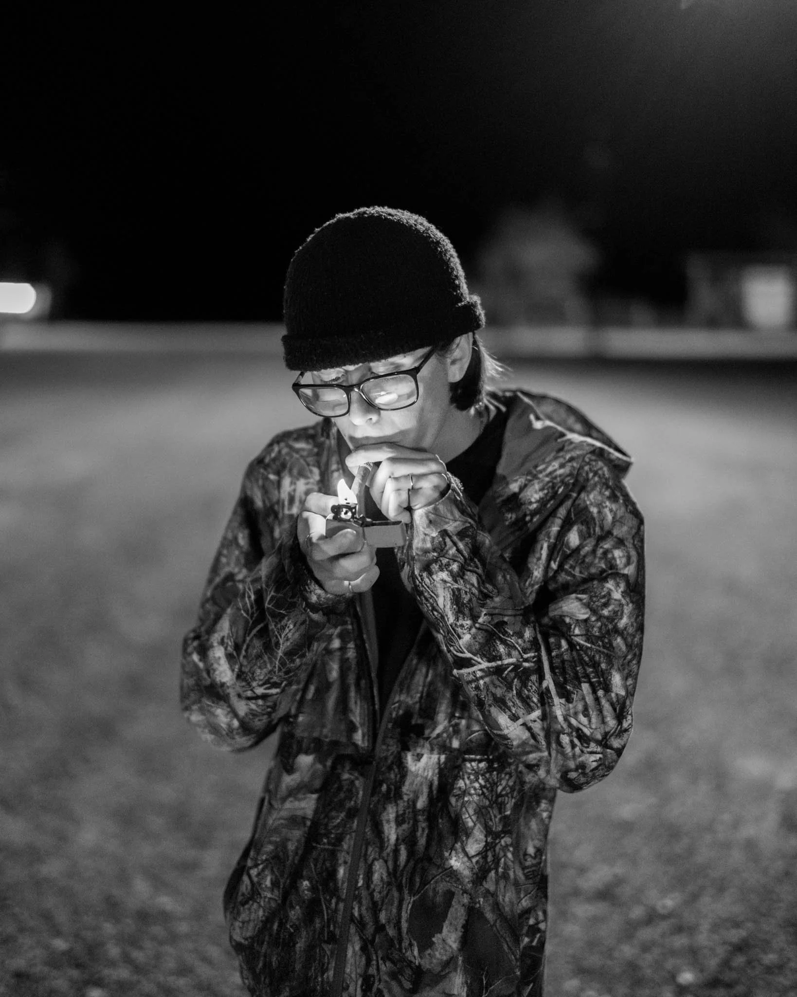
A Tri-X Experiment

Carrington, ND
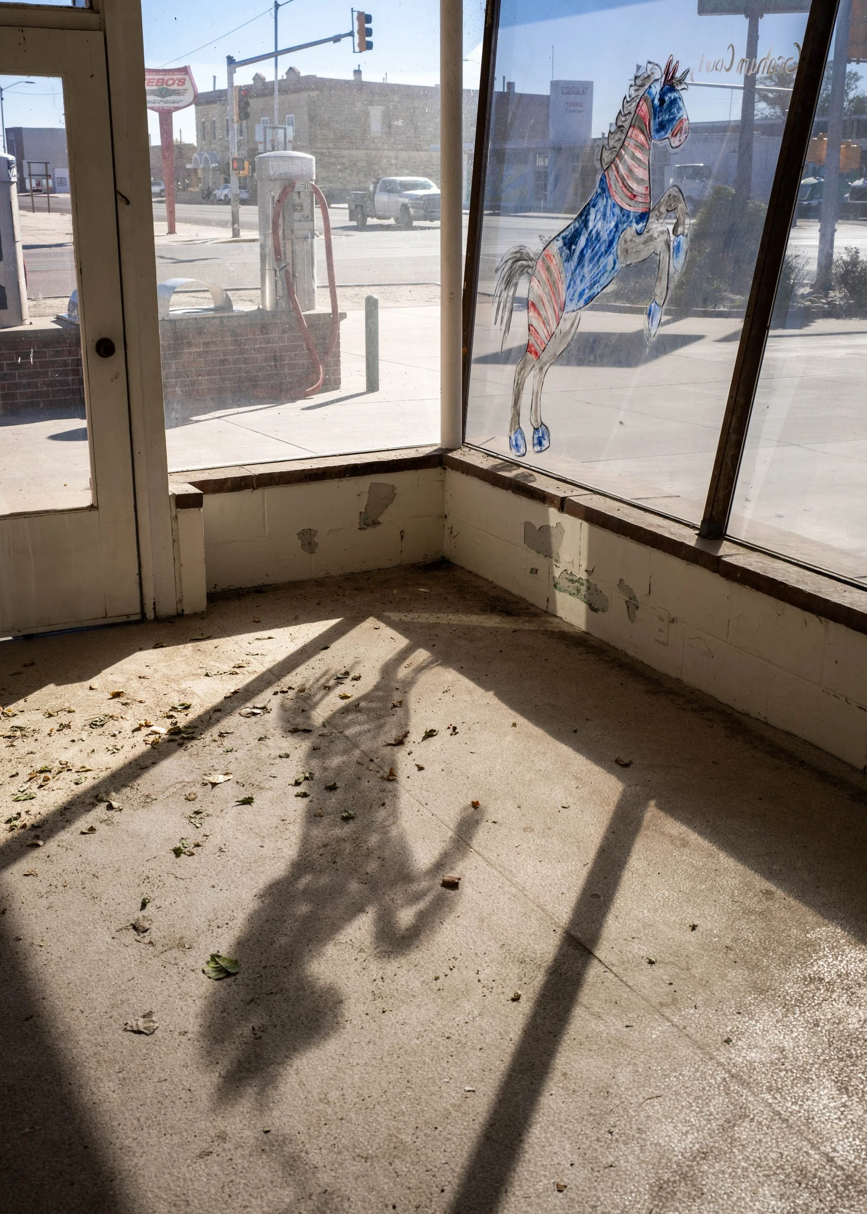
I recently happened across the project “Main Street: The Lost Dream of Route 66” by the late Edward Keating. Keating worked on the project between 2000 and 2011 and published a book with Damiani in 2018. Keating in the book talks about traveling west on Route 66 in 1977 as a young alcoholic searching for direction. It was on that trip that he finally decided to get sober. Keating returned in 2000 and described being on the road as “[seeing] devastation everywhere…Rote 66 was now little more than a catch drain for those who couldn’t keep up, its blacktop crumbling along with its people.” The photo project is not your typical collection of Route 66 images such as old motels and neon signs with a sense of nostalgia for a supposed better time somewhere in the mid-century. This project is a gritty, honest look at the people and places on Route 66. There’s no nostalgia here. Of everything ever done on Route 66, this may be the best and most honest look at the famed Mother Road (except perhaps for Steinbeck’s Grapes of Wrath, in which the term “Mother Road” was coined).

Edward Keating
Amarillo, TX (Working Girl in the Cattleman Cafe) - 2000
One of the aspects of the work that gives it that raw edge is the fact it was all shot on 35mm black and white film (likely Kodak Tri-X). The images are grainy, sometimes there’s some camera shake, or something’s not quite in focus, and a loss of acute details. All these aspects, in my opinion, remove some of the reality from the images. You know what you’re looking at is real, but with the lack of life-like clarity the images have a bit of feeling as being surreal. Maybe this wasn’t reality, just a bad dream.

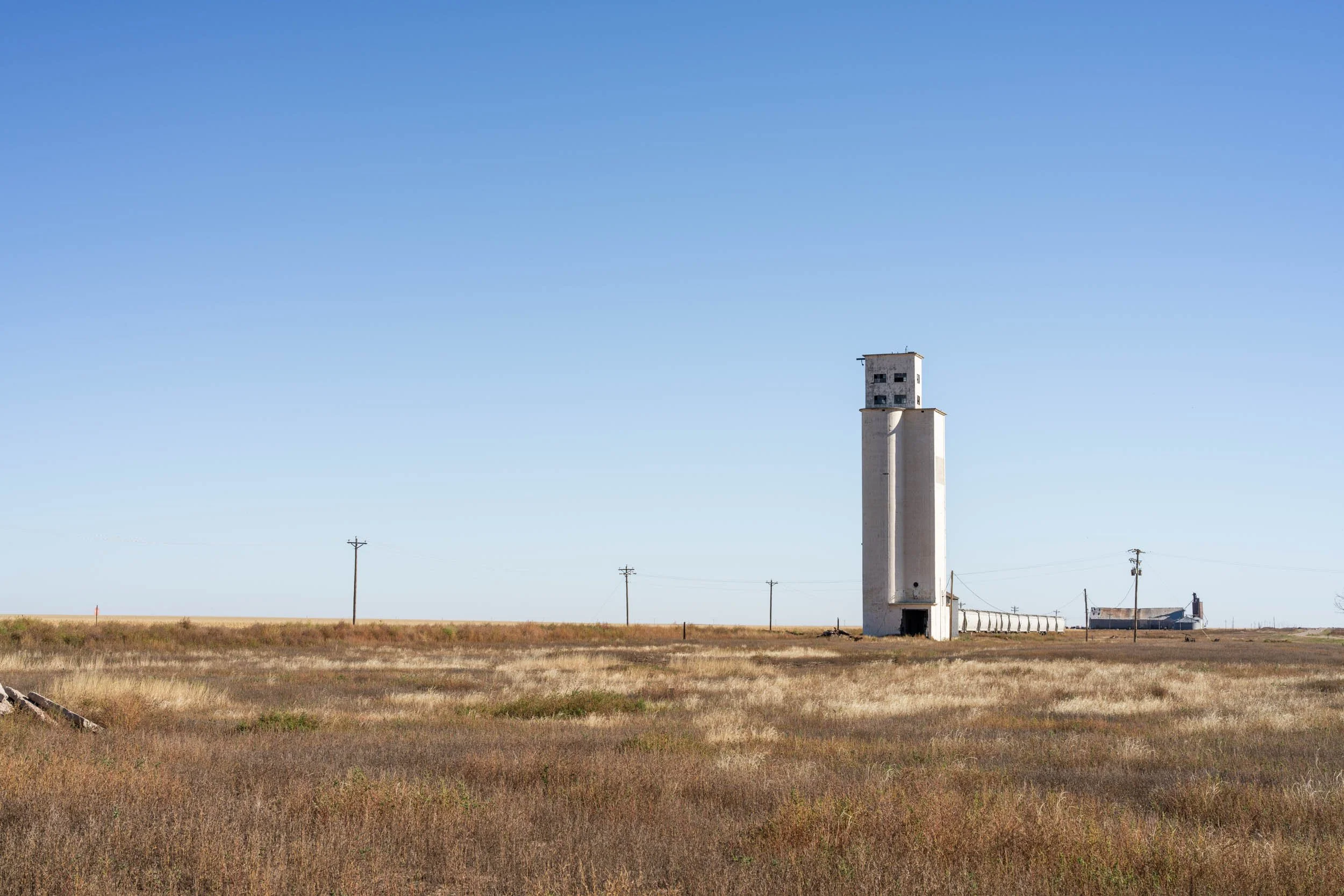
Kensal, ND
In my photography I’ve always tended towards the opposite, very clean photos with a lot of detail. I moved on from 35mm to medium format pretty early in my “serious” photography, and eventually on to 4x5 and high resolution digital. But I’ve always had a soft spot for that gritty, grainy, and more loosely composed photography of legends like Robert Frank, Larry Towell, and Todd Webb, even if it was never really my style. After coming across Keating’s work recently it made me think maybe I should experiment with this medium, it’s been over 20 years since I shot a roll of Tri-X.

Rodeo, Strasburg, ND
I put in an order for some Tri-X and dug out my old Canon AE-1 and Nikon FE2 that haven’t done anything but hold down a shelf for well over a decade, cleaned everything, and ordered some new batteries. My thinking was one body could shoot at box speed and the other could be pushed a few stops for low light situations. I’ve been carrying around these cameras for about a month using them almost exclusively. I’ve finally gotten around to developing the rolls and scanning the film.

Rodeo, Strasburg, ND
The experiment has been a mixed result for me. I definitely enjoy the grain and loosening up in my style a lot. But it also reminds me of just how challenging it is to work with 35mm film (which makes the work of someone like Keating all the more impressive). You’re stuck with whatever the film speed is you have in the camera (unless you want to take on the challenge of removing and later reusing a partial roll), focusing is hard in low light, and you never really know if it’s going to work out the way you envisioned it. Sometimes that’s OK. The first image on this post at Carrington, ND, has two strange arcs on the right side of the image, which was the result of the film jamming on the developing spool when I was loading it and creating a crease in the film. I like the way it worked out on this image (and you’d never create that digitally), but on a different image it may have been unusable.

West of Aanamoose, ND
The main goal of this experiment was just to do something different for a while. Sometimes we get so locked into our own style it becomes somewhat boring. This allowed me to change things up a little bit and work within the constraints of the film and cameras to make something work. The jury’s still out on how much more 35mm film I’ll continue to shoot in the future, but this has certainly been a needed break from what I usually do.
And it sure is hard to beat that grainy Tri-X look!

Rodeo, Strasburg, ND
Favorite Fifteen of 2024

St. Joe, ND
2025 is here and naturally a lot of us are reflecting on the previous year. I made a lot of pictures in 2024, and like most honest photographers, the majority are bad, or at best, mediocre. But I did make quite a few I do really like, and these fifteen are perhaps my favorite for the year. The photos presented here will go in roughly chronological order (except for the image above). Here’s hoping 2025 will be even more productive!

My friend and co-author Joel Jensen at Russell Springs, Kansas. We were doing research for a follow-up article about railroads in Kansas to the one published early this year in the National Railway Historical Society’s magazine The Bulletin. At This was the location of the depot at Russell Springs that served the Colorado, Kansas, and Oklahoma Railroad, which only existed from 1911 to 1918. Part of the foundation can be seen at the right.

Clayton getting a backyard hair cut in Lindsborg, Kansas.

Carol taking in the view of the Flint Hills from the old townsite of Teterville, KS (near Cassoday). I ran into Carol and her daughter at a roadside information kiosk east of Cassoday, they were looking for some interesting places to take photos at sunset, so I guided them to a few locations I had scouted on a previous day. Carol was nice enough to let me take her photo.

Herman Kulla, the oldest resident of my hometown of Kensal, ND. Herman is now 100 years of age but you wouldn’t guess it based on how active he remains. Herman is a marine veteran of World War II and ran a bar in Kensal for over 40 years. I was able to photograph him during the annual Memorial Day ceremony the American Legion puts on in Kensal.

Collin Mertz cleaning out a grain bin on his family farm near Hurdsfield, ND. This was an outtake from an article I photographed for the Wall Street Journal about the widening political gap between young men and young women. This was a nice assignment to get as I only had to travel 18 miles from home rather than what’s usually over 100.

Vern fishing north of Tuttle, ND. On a whim I drove out to this lake on the off chance I might find someone to photograph. Usually it doesn’t work out but on this day it did as Vern was there fishing. He was really happy to have a conversation and didn’t even mind if I took his photo. It turns out Vern is a bit of a local legend in the area, most everyone knows him, and he spends a lot of time working with young people either teaching them about fishing or teaching his trade, welding.

Bronc riding at the Ranch Rodeo at the Oliver County Fair in Center, ND. This was an outtake from an article I photographed for Bloomberg Businessweek about a plan to store carbon underground in western North Dakota. The article was written by Adam Willis and gives a nuanced look at what is actually a pretty complex subject. One of the companies involved, Summit Carbon Solutions, is a sponsor of the Oliver County Fair, which is why I was there to photograph it.

Bethel Lutheran Church near Heimdal, ND. You could say this picture was inspired by Todd Hido’s work, maybe stolen from Todd Hido would be a better description! This was one of those insane summer storms that pass through the plains that create intense, otherworldly colors and amazing clouds. No this image is not straight out of camera, but what it looked like in reality was very close to how I processed the image.

Sherry Furcht, who had to close her pharmacy in Bismarck, ND, in 2022, due in part to pressure from pharmacy benefit managers, or PBMs. I photographed Sherry as part of an article in the New York Times about how PBMs are driving independent pharmacies out of business and creating “pharmacy deserts.”

Emma and the town cat, Lost Springs, Wyoming. This photo was made on part of a two week trip through the Great Plains (Great Plains Rambling….get it?). Lost Springs is a pretty neat town. Unfortunately the bar had closed since the last time I was there but a little antique store is still going. By chance it was open because the owner of the store and Emma’s family are related. In fact the entire citizenry of the town was present in the store, all three of them. With myself and Emma’s family we actually outnumbered the people of Lost Springs! I tried to convince the three citizens of town to gather for a picture but could only wrangle 2/3 of them. That picture wasn’t as interesting as I had hoped for but immediately after the group dispersed this cat wandered in and Emma lingered behind to pet the cat, resulting in this picture. Some of the best photojournalists advise the best photos are before and after an event, it pays to come early and stay late. This was completely true in this instance, if I had just taken the group photo and then gave up I would’ve missed this scene.
Angelo, Martinsdale, MT. As part of this Great Plains trip I spent a night at a very rustic and vintage wood hotel in Martinsdale. Angelo, his friend Jaiden (who runs Veca Vision Media in Bozeman if you need video production work in that area), and Angelo’s dad were staying there for the opening of antelope season the next morning. I spoke with them for several hours out on Main Street, we only had to move for a car once after the bar across the street closed for the night.

A somewhat bored spectator to the Union Pacific Big Boy steam engine stop in Hays, Kansas. Her shirt does sort of sum up what a lot of us photographers do.

A moonrise near Kief, ND. I had actually stopped to photograph a scene looking to the left and when I turned around this is what I saw. It far surpasses what I had originally photographed.

The “leaning house” near Denhoff, ND. I had previously photographed this house in much more pleasant weather and made a mental note to return when there was snow on the ground. This was even better, snow on the ground and falling from the sky. Even though ND is thought of as having very few trees there were actually quite a few planted as part of the shelter belt movement following the “dirty thirties” to cut down on soil erosion. It’s actually quite uncommon to find a house like this surrounded by empty plains as most farmsteads had trees planted all around them, so between the emptiness and the leaning this house is pretty special (not to mention the derelict windmill).
Thanks for following along!
Memorial Day 2024

My hometown of Kensal, ND, has a program for Memorial Day every year. I’m not sure when the first one was held but the tradition continues thanks the members of the American Legion and Sons of the American Legion John Florhaug Post 103. There is a presentation held at the school gym followed by a flag raising and salute at the town’s two cemeteries. The community hosts a lunch at the Catholic Church and a raffle and socializing at the Legion Hall wrap up the day. Most if not all of the town attended the program this year as well as many out-of-town friends and relatives. It’s one of the few events where you may get the chance to visit with people not seen in months or even years. The following are images from the day’s events. Be sure to get all the way to the end for a word about one of Kensal’s most special residents.


Herman Kulla is the oldest resident of Kensal at 100 years of age, but he seems much younger than that. Herman served in the Marines during WWII in Guam and Iwo Jima. In 1957 he purchased a bar in Kensal and ran it with his late wife Jean for the next 45 years. He was honored at this year’s program for being a member of the American Legion for 80 years. A great guy that we hope will be around for many years to come!
Kansas

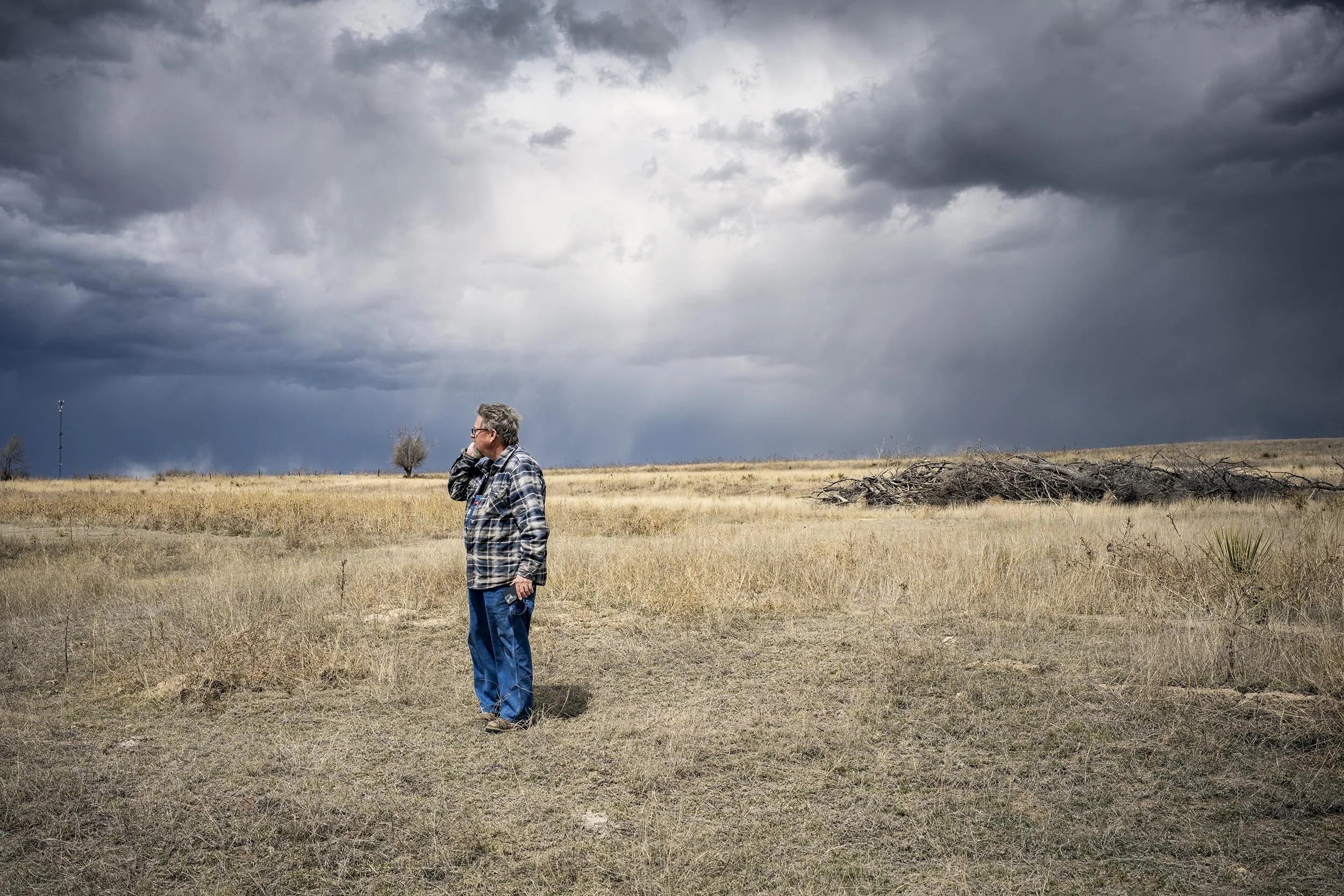
Isolated storm near Lindsborg, KS
I’ve been traveling to Kansas since 2016, initially to photograph for my “Driving Through Flyover Country” project and later to work on a project with Joel Jensen about the history and current state of railroads in Kansas, which was published in the National Railway Historical Society Bulletin in 2024. Our initial trip was in early 2020 and since then I’ve been back quite a few times in the intervening years. While the trips were focused on gathering information for the Bulletin article I also photographed quite a bit of “non-railroad” related photos, which evolved into my “Wheat State” project. I was pretty satisfied with what I had gathered for “Wheat State” but Joel suggested making “one more” trip to Kansas in April 2024. I had vacation and it sounded good to me, so in early April I headed south from North Dakota for “one more” trip to Kansas.
Kansas is an interesting state, most people think of it as just a flat, dry, dusty Great Plains state. For the western half, beyond the 100th Meridian, that’s quite true (and because of that it is my favorite part of the state). People forget that Kansas also shares a border with Missouri, and eastern Kansas looks much different than western Kansas, with many more trees, meadows, rivers, and some pretty substantial rolling hills. In the middle is the transition zone. Sharon Springs and Cherryvale are both in Kansas, but it feels like two completely different states. The amount of history in Kansas is mind-blowing as well, the eastern portions being settled before the Civil War and the railroads pushing west not long after. But the best part of Kansas is just how friendly everyone is! Midwest Nice is not just a cliche in Kansas, it’s definitely a real thing.
Part of my goal on this trip was to get more portraits for “Wheat State,” something I’ve always struggled with. The stars must’ve aligned on this trip because very few people turned me down when I asked if I could photograph them. I gathered so much new material on this trip it’s going to result in completely starting over with “Wheat State,” but that’s OK, because it should only make it better. In this blog entry I want to share some of my favorite photos I gathered on this trip to Kansas.


My Top 10 from 2023
As 2023 wraps up I revisited the many photos I made over the course of the year trying to narrow it down to my top 10 favorites from the year. I could’ve easily had 15, getting rid of those last five involved some difficult choices, but these, to me, top everything from the year.

Stevie at Urban Stampede Coffee in Grand Forks, ND. The afternoon February light was coming through the windows perfectly and I needed coffee to warm up since it was well below zero outside. This photo is an outtake from an assignment I photographed for the Wall Street Journal about the proposed (and since halted) Fufeng corn mill in Grand Forks.

A frosty road in McClean County, ND, in February. My friend Joshua was visiting ND for the first time and we happened upon this scene while traveling to the western part of the state. This photo was selected as part of Dodho Magazine’s Monochromatic 2023 book.

Bobby having lunch at Pam’s Cafe in Pleasant Hill, IL, in April. I was visiting my friend Jerry in Pleasant Hill and he introduced me to Bobby, we had a conversation about the feed store his family used to own in town.

Floyd lighting his corncob pipe in Atchison, KS, in April. Floyd came down to a park along the Missouri River each morning to feed “his” cats, some strays that hang around the park. He cuts up cigars to use for pipe tobacco and then watches barges go by or visits with people in the park.

A barn swallow in an abandoned house in Benson County, ND, in May. I was pretty lucky to capture the bird’s wings extended like this at just the right moment. Since I was using a flash there was only one shot to get it. The bird escaped the house right after this photo.

Dairy Queen in Grand Forks, ND, in June. This was an outtake from an assignment I photographed for the German magazine Capital about the Fufeng corn mill in Grand Forks.

Citizens of Butte, ND, watch an Independence Day fireworks show on July 4. Butte has a population of about 70 but was able to raise funds for their own fireworks show and Independence Day celebration. They had enough fireworks to go for nearly two hours.

A Mid-Dakota League softball game in Woodworth, ND. I didn’t even know this league existed, I just happened to come across this game driving through Woodworth on my way to somewhere else. Woodworth has a population of only 44 but still manages to field and host its own softball team.

Dana and his brother Ethan, both of Robson Honey, pull honey from bee hives near Carrington, ND, in September. North Dakota is the top honey producing state in the nation and I photographed a few different apiaries this fall for a project looking at honey production in North Dakota. Right now these bees should be enjoying warm weather somewhere in Texas.
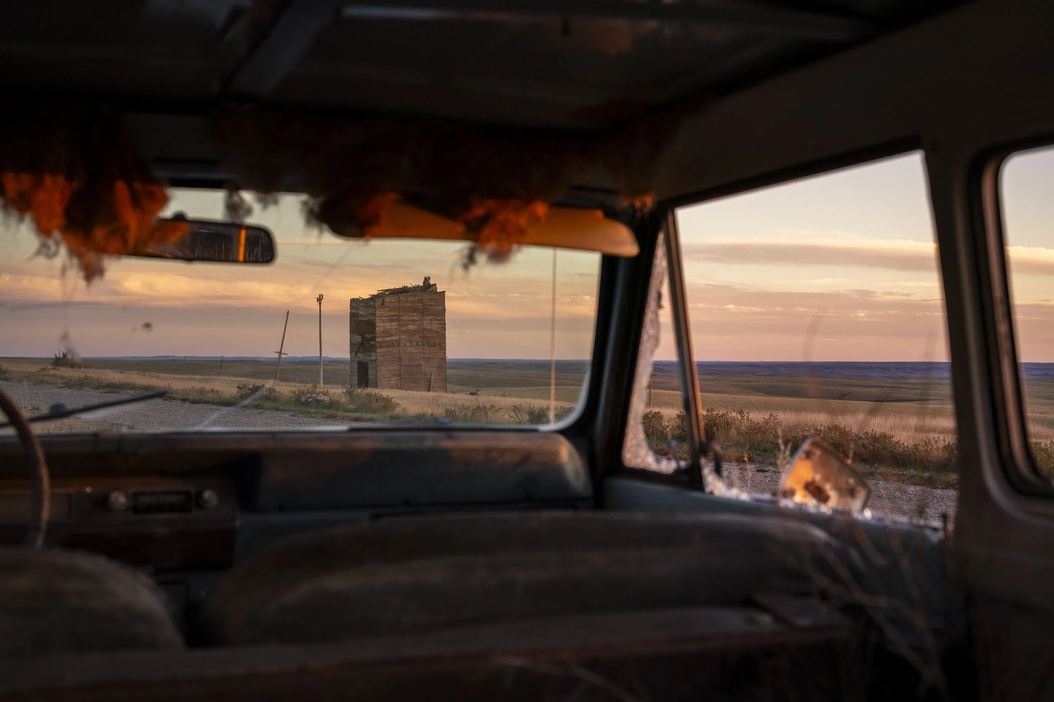
The remains of a grain elevator as seen through an International Scout at Okaton, SD, in October. This was the first day of a two week road trip to the four corners region. I wanted to shoot this elevator at sunset and had planned for it. I didn’t plan on the Scout being there. Late afternoon clouds had rolled in obscuring the sunset, but I got lucky and the sun found a hole for just a few minutes, just enough time to get this photo.
Epic Road Trip to the Four Corners: Part II

Fire damaged trees in Mesa Verde National Park
Thanks for following along with me on the first half of my two week road trip to the four corners region of America. Following my night in Durango, CO, I continued west to Mesa Verde National Park. Unfortunately it was too late in the season to go on a guided tour of a cliff dwelling, but I did manage to stay at the lodge in the park just in time; that would be closing the day after my stay. Mesa Verde has been photographed to death, I spent more time just “being there” than I did photographing, and when I did bring out the camera I enjoyed photographing other visitors more than the dwellings. Just taking in the landscape was more rewarding than trying to photograph it.

A visitor to Mesa Verde National Park
I had all morning to continue exploring Mesa Verde before again heading west to Monument Valley in Arizona. This is another place that has been photographed to death (including John Ford), but I’ve always wanted to see it. I elected to get a guided tour by a Diné (Navajo) tour company, which was worth it. It saved some wear and tear on my vehicle since the road through the park is pretty rough, but it also allowed me into parts of the park off limits without a tour. Our guide, Marjorie, also provided us with information about the Navajo culture. The tour ended at sunset and I again mostly just enjoyed “being there” or photographing visitors photographing the valley.

Marjorie, my tour guide through Monument Valley

Monument Valley at sunset

The trading post at Monument Valley

Sunrise at Monument Valley
I stayed at the hotel located within Monument Valley Tribal Park which made staying for sunset and waking up for sunrise much easier! The next day I made a loop to some cultural sites located in southeast Utah. But on my way out I had to stop by “Forrest Gump Point,” where in the movie Forrest Gump the protagonist decides to stop running after going nonstop for years. “I’m pretty tired…I think I’ll go home now.” Forrest Gump Point has become so popular the state of Utah had to build additional turnouts and erect signs warning motorists of pedestrians. In my time there quite a few cars stopped, and a large number were actually foreigners on vacation.
From there I visited much more ancient cliff dwelling sites in the region before making my way towards Mexican Hat, UT, for the night. On my way to Mexican Hat I came across the Moki Dugway, a steep road that switchbacks down a sheer cliff from the top of a mesa. The view from the top was unbelievable since it was basically just a straight drop to the floor below. At the top of the Moki Dugway I also visited with Alice, a member of the Navajo Nation, who was selling handmade jewelry. Her mother is over 100 years old and one of her daughters is a professional chef. She also told me about a nearby spot overlooking the San Jose River called Muley Point that I didn’t know about, it was a pretty spectacular spot I wouldn’t have known about had I not spoke to Alice. After making my way down the cliff I made a quick stop at Goosenecks State Park before calling it a night at Mexican Hat where I had the entire motel to myself.

Tourists standing where Forrest Gump stood

The view from the top of the Moki Dugway near Mexican Hat, UT. The road below is where you eventually end up.

Alice, a member of the Navajo Nation, selling her handmade jewelry from the top of the Moki Dugway

Muley Point near Mexican Hat, UT
The next day I had a leisurely drive to make to Bloomfield, NM. On the way though I stopped by Hovenweep National Monument and the Lowry Pueblo. I also actually made it to the Four Corners monument but only had about five minutes to spend there before it closed. It was then on to Bloomfield to spend the night.

Make it stand out
The road to Hovenweep
I stayed in Bloomfield, NM, because it was the closest town with a motel to the Chaco Culture National Historic Park located southwest of Nageezi. I wanted to spend the entire day at Chaco and I did. Chaco contains massive pueblos built by the Ancient Puebloan Culture 800 and more years ago. It’s a lot to try and explain here, I suggest researching it, or better yet, visiting it. Standing in the plaza of an 800 year old pueblo that was five stories high is an experience you can’t replicate. I took some photos, but again, mostly I just enjoyed being there. After spending nearly all day at Chaco I made a mad dash for Las Vegas, NM, and spent the night at the Regal Inn, featured in the Coen Brothers film No Country For Old Men. I spent a little time photographing Las Vegas at night and happened across a closed western wear store that was also featured in the film.

Pueblo Bonito at Chaco Canyon

Near Nageezi, NM

A closed western wear store in Las Vegas, NM. The interior was used in the film No Country For Old Men.
I woke up to overcast skies, frost, and fog in Las Vegas, but at least avoided the snow the country to the north got. I had to get to Fort Lupton, CO, that evening but didn’t want to go directly there via I-25, instead electing to take back roads out onto the New Mexico plains. One town I went through, Roy, presented endless opportunities for photographs. Roy has the distinction of being the brief home of Bob Wills when he was a barber just before hitting it big with his “Western swing” style of music. I made my way up the New Mexico and Colorado plains to arrive in Fort Lupton where I would stay with an aunt and uncle for a day before beginning the last leg home.

Make it stand
Roy, NM

José was passing through Roy on his way to Solano, NM, which was named for some of his ancestors. He had never visited the town before.

The New Mexico plains north of Roy
My aunt had an appointment with Craig, a horse Ferrier, the next morning to have one of her horse’s hoofs trimmed. We spent the rest of the day in Denver, but the next day they invited their friend Casey over to visit. Casey is 95 and had a career on the Denver and Rio Grande Western Railway starting as a switchman in 1947. He had some great stories to tell about the old days of railroading. His other hobby was collecting and restoring cars. After visiting with Casey most of the morning I had to hit the road towards home. I stopped in a few more Colorado plains towns to photograph, including Keota. I didn’t realize it at the time, but I nearly recreated a photo of Keota taken by Farm Security Administration photographer Arthur Rothstein in 1939. The photo was labeled as “town abandoned due to continuous crop failures.” I spent the night in Alliance, NE, my last night on the road.

Craig, a horse Ferrier, smooths out a horse hoof after trimming near Fort Lupton, CO

Casey is 95 and started his railroad career in 1947

Keota, CO

Arthur Rothstein’s FSA photo of Keota in 1939
In my last day on the road I had to get from Alliance back to North Dakota. It didn’t leave a lot of time for photos but I did make a few along the way, including an abandoned bar in Scenic, SD, and an old car with a message at Conata, SD. Since I was so close I had to stop at Wall and visit Wall Drug. Even though the place is a tourist trap they have a fantastic book store. I usually find a book or two in there and this trip was no different. I made my last photo of the trip in Midland, SD, at my favorite abandoned place, a combined service station and cafe that closed in 1997. I would’ve loved to have been there when it was open. From there it was just a long drive back home. My trip odometer ready EXACTLY 4100 miles when I pulled into the driveway.

An abandoned bar in Scenic, SD

Conata, SD

The last image of the trip, a closed cafe in Midland, SD
Epic Road Trip to the Four Corners: Part I

In recent years I’ve begun to take two weeks of vacation together to do a massive road trip somewhere in the United States, usually in the fall. This year’s two-week trip took me to the four corners region with plans to ride both major narrow gauge railroads in Colorado, visit Mesa Verde National Park, Monument Valley Tribal Park, and Chaco Culture National Historic Park, and whatever caught my eye along the way. With two weeks available to do the trip it allowed time for stopping for photographs along the way of whatever I came across. Part I will take us from North Dakota to Durango, CO.

I try to avoid interstates on my road trips as much as possible and stick to the less traveled two-lanes (William Least Heat-Moon’s “blue highways”), and that’s how I started my trip, meandering down some various highways in a not-very-straight-line from ND to central South Dakota. In the near-ghost town of Draper, SD, I explored what was left of Main Street and in a long abandoned apartment I found this Resistol hat. What cowboy leaves his hat behind?

The Sioux Motel at Murdo, SD, was where I found to spend the first night because my goal was to photograph the decrepit grain elevator at Okaton at sunset. I checked into my room and headed for Okaton, which someone once tried to make into an old west-style tourist trap but these days is another near-ghost town. An old International Scout made a great frame for the elevator and the sun poked out between clouds for just a minute to get this photo.

After the sun set I returned to Murdo and had a buffalo burger at a local steakhouse that looked like something still stuck in the 1980s, but good food! I took a few night photos around Murdo and made one final image of my motel. Back when I was shooting more 4x5 the next hour or so would’ve been spent replenishing film holders, instead I could just relax. That’s one aspect of large format I don’t miss, evenings spent changing out film holders.

The next morning I grabbed some coffee at one of the local gas stations and this scene presented itself right from my car window. I continued making my way south into the sand hills of Nebraska.

An abandoned elevator and sunflowers in Crookston, NE

North of Mullen, NE, I stopped at a roadside historic marker and read about a country church nearby called the Dry Valley Church. It sounded like the church was still standing so I drove down a narrow road going off into the sand hills and found it out in a pasture. While it was interesting to see the best photo was of the front gates and the track leading through the grass away from the church. From here I made my way to North Platte, NE, where I spent the night.
After breakfast in North Platte I continued to wander south through some small Nebraska towns and into Kansas, my second favorite state after ND. I photographed a church not far into Kansas and then came into Hill City where I found this old service station adorned with the local school mascot.

A friend of mine recommended the Walter Chrysler boyhood home in Ellis, KS, now open to the public with a small museum. Chrysler got his start as an engine wiper at the Union Pacific Railroad roundhouse in Ellis before moving on to make it big in the automobile world. It was an interesting stop with some interesting artifacts, such as a restored version of the first model car Chrysler produced.

After the Chrysler home I went out to visit some of the spectacular churches in the communities around Hays that were settled by Germans-from-Russia. They erected massive, opulent churches and frequently used wrought-iron crosses as grave markers. While most of the churches remain standing the Sacred Heart Church at the crossroads of Emmeram, KS, didn’t make it. The stone church closed in the 1960s and burned (likely from arson) in the late 90’s. Today its ruins make you think of the ruins you’d find in Greece or Rome.

After photographing the churches I was a bit behind as I had to make it to Antonito, CO the following day so I wanted to get as far west as I reasonably could. But I couldn’t pass up this scene in Utica, KS.

I never did make it as far west as I’d hoped, instead opting to call it a night at the Lazy R Motel in Scott City, KS.

The next morning my travels brought me close to Horace, KS, and I couldn’t pass up another opportunity to photograph the abandoned Missouri Pacific Railroad depot in town. The light coming into the operator’s bay window was perfect.
Leaving Scott City I knew it would be a bit of a push to make it to Antonito by sunset. It’s not that it’s far, I just tend to get distracted stopping to investigate things and make photos along the way. I couldn’t pass up this skinny elevator on the Colorado plains at Bartlett.

A shot up car in Andrix, CO, was another roadside distraction.

I made it to Antonito, CO, not long after sunset and checked into my hotel. Antonito lies in the San Luis Valley and has traditionally been a ranching and farming town, though tourism is getting bigger. The Dutch Mill bar and cafe is an icon of Antonito’s Main Street. At this time of year it was pretty quiet, mostly just the locals and me.

What brought me to Antonito was the Cumbres and Toltec Railroad, a narrow gauge tourist steam railroad that runs between Antonito and Chama, NM, on former Denver and Rio Grande Railroad track. The DRGW depot in Antonito still stands and was located right behind my hotel.

The next morning I boarded a Cumbres and Toltect charter bus in Antonito which would take us to Chama where we would board the train.

Leaving Chama the railroad has to pull up a 4% grade, which is really steep for a railroad, and requires double heading steam to pull the train up a mountain to Cumbres Pass, just above 10,000 feet. Here the train is nearing the top of the pass. The Cumbres and Toltec is owned by the states of Colorado and New Mexico who purchased the track from the Denver and Rio Grande Western in 1970. The DRGW operated an extensive network of narrow gauge track in Colorado and New Mexico at one time. Narrow gauge has a 3 foot gauge compared to the standard 4 feet 8.5 inch gauge of the rest of the North American rail system. The smaller gauge allowed for tighter curves, ideal for building in the rugged Rocky Mountains. The last operating portion of DRGW narrow gauge ran from Alamosa, CO, to Antonito, Chama, and on to Durango, CO. At Durango a line went north to Silverton and south to Farmington, NM. This narrow gauge operation lasted until 1968 due to natural gas drilling in the Farmington area that required bringing in supplies by rail. It has the distinction of being the last Class I steam freight operation in the USA. Everything between Chama and Durango and Farmington was removed by 1970. The Durango to Silverton portion survived because it had become such a tourist attraction the Interstate Commerce Commission wouldn’t allow the DRGW to abandon it. We’ll see that operation in a few days.

It was a pleasant fall day, perfect for riding the open car or end platforms as the train made its way through the mountains.

The train ride takes most of the day to get from Chama to Antonito with a catered lunch stop at Osier. We were nearing the end of the line in this photo, nearly back to Antonito.

I spent another night in Antonito and the next morning I saw some activity happening in the parking lot across the street from my hotel. There were several trailers filled with watermelons, bags, and boxes that were being handed out to people. I spoke to some of the people and found out it was an annual event sponsored by the Conejos County Veterans Affairs and the volunteer fire departments of Antonito and Romeo to give away a free food package to area veterans. The organizer told me he’d like to do it more than once a year but hasn’t been able to increase the frequency yet.

After photographing the event in Antonito I had the entire day to make my way to Durango, CO. Fall colors on the aspen trees in the area were unusually late this year, I encountered them at just past their peak, but not by much.

Coming over La Manga Pass on the highway between Antonito and Chama the mountains fall away into a scenic valley where the DRGW narrow gauge makes a huge horseshoe curve climbing towards Cumbres Pass. I thought how great it would be to see a train, but the passenger season was over. Imagine my surprise when I saw a little smoke in the distance. A train! I found out later in the day the Cumbres and Toltec was deadheading freight equipment from Antonito back to Chama after it was used on a photo charter earlier in the week. I couldn’t have gotten more lucky. Here the train is arriving at Cumbres Pass.

The Cumbres and Toltec freight car move is descending the 4% grade into Chama.
After photographing the Cumbres and Toltec train at Chama it was time for lunch. Since it was a Sunday about the only place open was Foster’s, a saloon that has been in business since the town was founded in 1881. This wasn’t your typical bar food though, it was some of the best street-style tacos I’ve ever had.
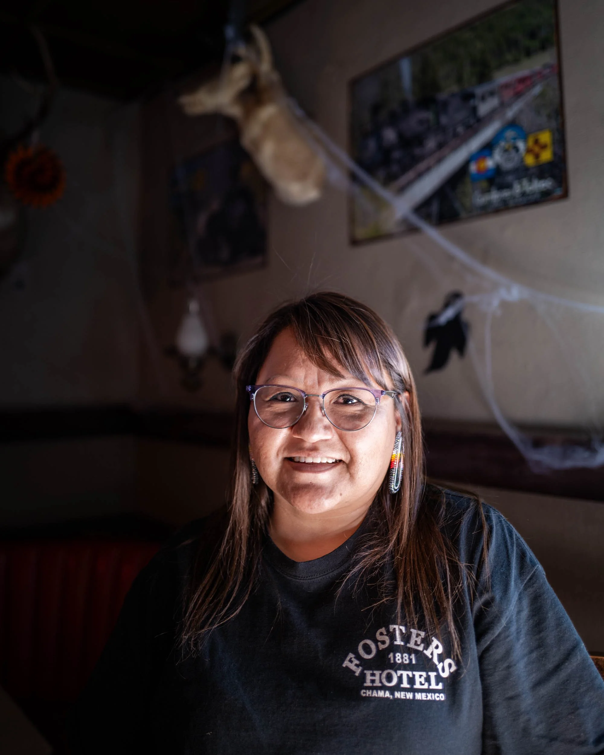
Michelle claims to be the friendliest bartender at Fosters. We had a pretty good conversation on the differences between New Mexico and North Dakota.

From Chama I casually made my way to Durango, CO, where I had a ticket to ride the Durango and Silverton Narrow Gauge Railroad the next morning. As previously stated the DSNG was part of the Rio Grande narrow gauge system in Colorado and New Mexico, originally built to move ore out of the Silverton area. After the Silverton mines played out the line was nearly abandoned, but after appearing in some films the’s lines appeal as a tourist ride grew. It became so popular the Interstate Commerce Commission didn’t allow the DRGW to abandon it. The Rio Grande continued to operate the tourist trains until 1980 when it was finally sold to a private operator. It remains a popular ride today and still appears in movies.

The towering mountains and narrow canyons the DSNG passes through between Durango and Silverton are what draw riders to the trains. Virtually none of the railroad is accessible by vehicle, and the train is even used to bring hikers in and out of backcountry trails.

Once the train arrives in Silverton passengers disembark for two hours to explore the town and get lunch. The entire train is then backed around a wye to turn it in the right direction for the trip back to Durango. I skipped the shopping to photograph the train backing past the DRGW depot on its way to the wye.

I did allow some time to have a few drinks at the Lacey Rose Saloon in Silverton however. The bartender told me how heavy winter snows the previous year completely isolated Silverton for two weeks before the highway could be opened.

It was just as spectacular riding back to Durango as it was going to Silverton. We arrived back just after sunset, a flagman stopping traffic on the crossing next to the depot in downtown Durango. Afterwards I wandered around historic downtown Durango, found a few interesting places to have a drink, and retired for the evening.
This concluded the first week of my trip. Look for Part II to come soon.
Medora

A sign for Medora, ND, mimics the iconic Hollywood sign and is set on a bluff above the Medora Musical stage.
Earlier this fall I had the opportunity to photograph Medora, ND, for a New York Times article about the Theodore Roosevelt Presidential Library being built there. Medora is a tiny town in the western North Dakota badlands with a year-round population of about 125. So what does Theodore Roosevelt have to do with Medora? Roosevelt first came to the area in 1883 to shoot a buffalo, wishing to do so before they were all gone. Apparently the irony of killing one of the few remaining buffalo was lost on Roosevelt (today the mounted head from that hunt remains on display at Roosevelt’s Oyster Bay home). A year later, following the death of his mother and wife on the same day, Roosevelt came back to try his hand at ranching. His first operation was the Maltese Cross Ranch located south of Medora, but he later established the Elkhorn Ranch north of town, the site of which today is part of Theodore Roosevelt National Park. Though his time in the badlands was short it was probably the most formative experience of his life. “I never would have been President had it not been for my time in [North] Dakota!” This is why there is such a connection between Medora and Roosevelt.

Downtown Medora. The Rough Riders Hotel (originally called “The Metropolitan”) was built in 1884. It went through its first renovation in 1963 when businessman Harold Schafer, the man credited with making Medora into the tourist destination it is today, bought it. In 2010 the hotel underwent another major renovation. Many of the buildings in Medora are modeled to have the look of an old west town.
Medora started as not much more than a tent-town station stop along the Northern Pacific Railroad known as “Little Missouri,” named for the nearby creek that carved out the badlands. Little Missouri is where Roosevelt disembarked from the train for his buffalo hunt. The Marquis de Mores, a French nobleman, founded Medora in 1883 and named the town for his wife, Medora von Hoffman. The Marquis’ plan was to slaughter and pack beef right in Medora and ship it in refrigerated boxcars east. At the time cattle was normally shipped “on the hoof” to packing plants in Chicago, but the journey was stressful on cattle and caused them to shed weight on the way, which meant shedding profits to cattleman. The Marquis thought he could maximize profits by packing beef right where it was fattened up on the Dakota grass.
The Marquis ran a packing plant on the west side of Medora that never was a resounding success. The plant closed in 1886 and burned in 1907, today just some foundations and a chimney remain. But that’s not all of the Marquis’ legacy that remains in Medora, his “Chateau de Mores", a “hunting cabin,” still stands south of town and is still furnished with many of the Marquis’ original possessions (including hundreds of wine bottles). The Chateau was built in 1883 but the de Mores only stayed in it for three years. Calling it a cabin seriously downplays its size, it would’ve been more like a mansion when it was built on the frontier. The de Mores hosted friends at the Chateau who came out to hunt. Roosevelt visited the Chateau a few times, and borrowed some of the books from the library, but the Marquis and Roosevelt were never exactly friends. The de Mores never returned after 1886 and a hired caretaker kept the Chateau in order. It was finally given to the state in 1936 by the Marquis’ son with the condition it be maintained and open to the public, which it is to this day. The Marquis himself was killed in Algeria in 1896 on another business adventure.

A visitor at the Chateau de Mores

Edward, an Assistant Site Manager at the Chateau de Mores, discussed the history of the Chateau and of Medora in the Chateau’s mud room, where hunting expeditions were outfitted.

Badlands Pizza and Saloon in downtown Medora.
Roosevelt’s ranching time in Medora was pretty short. The winter of 1886-87 was particularly harsh and mostly wiped out the cattle ranchers, including Roosevelt, on the northern plains. Roosevelt returned to New York and resumed his political career, eventually culminating in becoming President with the assassination of William McKinley in 1901 and his outright election to the Presidency in 1904. Meanwhile, back in Medora, some people recognized the connection between Roosevelt and the badlands and saved his Maltese Cross Ranch cabin. The cabin was actually moved to the World’s Fair in St. Louis in 1904, during Roosevelt’s Presidency, and displayed there before going on tour to Portland before returning to North Dakota, first to Fargo and then to the state capitol grounds in Bismarck. In 1959 it returned home to the grounds of the Theodore Roosevelt National Park (the grasslands north of town became a national park in 1947) where it remains on display today.

Roosevelt’s Maltese Cross Ranch cabin on display at the Theodore Roosevelt National Park’s visitor center.

Lisa and Chuck, both from Tennessee, observe buffalo at Theodore Roosevelt National Park.
Theodore Roosevelt National Park was established in 1947. The park drew some tourists but one man really changed Medora into an all around tourist destination: Harold Schafer. Schafer was a North Dakota born businessman who established the Gold Seal Corporation (most famous for its “Mr. Bubble” brand). Schafer began buying up derelict buildings in Medora and restoring them as well as paying for infrastructure upgrades to the village. In 1965 Schafer bought the Burning Hills Amphitheater, an outdoor venue west of town with limited success, and turned it into the Medora Musical. The professional-level musical tells the history of the area and consistently draws large crowds through the summer season. Schafer’s vision for Medora as a tourist destination eventually came to fruition, and that’s the town’s main source of business today.

Lesko, a seasonal worker from Macedonia, tends bar at the Little Missouri Saloon.

Hats and dollar bills line the ceiling of the Little Missouri Saloon. The hats belong to local ranchers or ranch hands that worked in Medora. The dollar bills are from tourists. Once the ceiling is full the dollar bills are removed and donated to the local fire department.

Deb, a seasonal worker from Texas, admires a photo of Joe Ferris at the Ferris General Store. Roosevelt rented one of the rooms above the store to stay in during his trips into town. Today the store sells gifts and souvenirs.

A visitor at the North Dakota Cowboy Hall of Fame. The hall of fame was established in 1995 and features a museum telling the story of Native Americans, cowboys, and ranching in the area.

Kermit Roosevelt III is a lawyer, author, law professor, and the great-great-grandson of Theodore Roosevelt. Roosevelt III serves on the board of directors for the Theodore Roosevelt Presidential Library.

A statue of Theodor Roosevelt at the Theodore Roosevelt National Park Visitor’s Center is dressed in Roosevelt’s actual clothing.

Wild horses graze at Theodore Roosevelt National Park.
Thrashing Show Season

Starting on Labor Day weekend and continuing for three weekends there’s a string of threshing shows that happen in North Dakota, South Dakota, and Minnesota (a note on the title: the correct word is “threshing” but all the old-timers always referred to it as “thrashing”). Starting Labor Day weekend is the massive Western Minnesota Steam Thresher’s Reunion in Rollag, MN. This is the biggest show in the region, not only featuring steam, gas, and diesel farm equipment, but also construction equipment, vehicles, sawmills, a machine shop, a train, and so much more, all surrounded by historic buildings. There’s so much going on its hard to even cover the grounds in a day.
The next weekend there’s a smaller show in Drake, ND, simply known as the Drake Threshing Show, as well as one in Andover, SD, the James Valley Threshing Show. The next weekend is the Central Dakota Steam Thresher’s Reunion in New Rockford, ND. There’s also two other well-known shows in North Dakota that happen in July, the Crosby Threshing Bee in Crosby, ND, and the Makoti Threshing Show in Makoti, ND.
This year I made it to WMSTR in Rollag, the Drake Show, and the CNDSTR in New Rockford. The above image is from the New Rockford show. The next group of images is from the WMSTR Rollag show.


The following photos are from the Drake Threshing Show


And finally images from the CNDSTR in New Rockford, ND


Driving Through Flyover Country Preview
A few advance copies of my book Driving Through Flyover Country arrived at the publisher, here is a flip through the book. Driving Through Flyover Country is available from Subjectively Objective.
Wet Plate in the Field

My first attempt at making a tintype with the help of Kent Staubus
My friend Kent Staubus from South Dakota is a photographer that shoots a variety of cameras, from digital to film to his more recent hobby of tintype wet plate collodion photography. He had been wanting to come up to North Dakota to make a tintype of the Hurricane Lake Church north of York, ND, and finally got a chance to do it. I’ve read about the wet plate process and have admired the people that can pull it off, but I’ve never seen it done nor have I actually tried it. After watching Kent make a tintype he let me try my hand at it. The result wasn’t bad, certainly a lot more successful than if I had just been trying to pull it off on my own.

Kent checks out the Hurricane Lake Church
Kent has built a portable dark tent in for the back of his car allowing him to do this type of photography in the field. He hasn’t tried glass plates yet but has done tintypes in 4x5, 5x7, and 8x10. Though referred to as tintypes, they’re actually aluminum plates used for trophy engraving. The advantage is the emulsion side is covered with a plastic film so it stays clean right up to the point you remove the film, unlike glass which requires very careful cleaning prior to accepting the collodion.
To create the tintypes requires pouring collodion onto the plate then immersing it in a silver bath for four minutes. Once it comes out of the bath it’s sensitive to light and must be put in the film holder in darkness (though unlike modern film complete darkness isn’t required, you can use a safelight). From there it’s put in the camera and exposed. To determine exposure he does a test plate, exposing different parts of the plate for longer and longer time intervals, similar to making a test strip when printing in a darkroom. He can adjust the exposure based on the test. After it’s exposed it’s back into the dark tent to remove the plate and pour developer over the plate. It then goes into a tray of water to stop development and can now come back into the light. The plate goes through a few water rinses before being put into fixer. After this it’s more water rinses followed by a longer, more thorough rinse at home. The plate can then be varnished, making it archival, or at least archival enough that it will outlive any of us!

Kent’s modern 4x5 but with an 1880s vintage lens. He’s making the test exposures here. Since this lens is over 140 years old there’s no shutter, so he places his hand over the lens to “close the shutter.”

Kent’s dark tent in the back of his car. He’s pouring developer over the plate.

Pouring water over the plate to stop and rinse off the developer. Kent said occasionally he hasn’t brought enough water along and has resorted to getting some out of a slough to use, “just like those old guys had to do in the field sometimes!”

Pouring collodion onto the plate. This part is tricky, because you have to make sure the whole plate is covered evenly, and once it’s poured you can’t touch the plate or it’s ruined.

Waiting for a cloud to move so that the plate can be exposed under the same conditions as the test plate.

Rinsing the developer off of the plate.

Kent’s tintype after several rinses.
Mid-Dakota Softball

On a recent Tuesday I was out for a drive to investigate a lead on a rural church to photograph. On the way I thought I’d make a drive through the tiny town of Woodworth, ND, just to see if anything was going on. I was surprised to find that there actually was something going on! Down at the little ball diamond by the elevator was a softball game. I forgot about the church and decided to just stick around Woodworth and photograph this small town event.
I talked to some people and found out that Woodworth, with a population of about 44, is part of the Mid-Dakota Softball League. They play other local towns on Tuesdays. This game was between Woodworth and Pingree (population 42). To get the most out of it they played a double-header. One of the locals I spoke with said at one time Woodworth fielded six softball teams, five men’s and one women’s! Who says there’s nothing to do in a small town?


Zeke, Sharon, and their dog Jake watching the game. Zeke is retired but mows the grass for the ball diamond.


Dragging the infield after the game

After the game a player and his dog had their own softball game
The Reverend Bauer in Goodrich, ND

The Kassel Reformed Church near Lincoln Valley, ND
A year or so ago I came across a small book in an antique store titled “Erfahrungen Aus Meinen Missionarsleben in Den Dakotas,” translated as “Experiences from my Missionary Life in the Dakotas” by Reverend Peter Bauer, a pastor in the Reformed Church and one of the “Germans-from-Russia.” It looked like an interesting vernacular experience of early life on the northern Great Plains so I bought it. The text was written by Pastor Bauer sometime prior to his death in 1942 but the book itself was not published until later (I can’t find a date but I suspect it was the 1960s), translated from the original German by Armand and Elaine Bauer with supplemental information provided by people from the communities Pastor Bauer worked in. While the entire book was interesting, I was most intrigued by the time Pastor Bauer spent at the parish in Goodrich, ND, preaching to outlying congregations in Sheridan and Pierce Counties, which are close to where I live in Harvey. From the book I was able to photograph some of what remained from the Goodrich Parish.

Reverend Bauer’s book
Pastor Bauer was born in 1855 in Neuburg, South Russia (today the Odessa region of Ukraine). He was the pastor for a Reformed congregation in Worms. The area was home to large communities of ethnic Germans invited by Catherine the Great to settle the Black Sea and Volga River regions of Russia in the mid- to late 1700s. These Germans enjoyed cultural freedom for a time in Russia, they were allowed to live as autonomous communities in Russia, retaining their language and culture and being exempt from compulsory service in the Russian military. Things had begun to change by the 1870s with Russia now under the control of Alexander II. He wanted to assimilate these German communities into the Russian culture. They were no longer exempt from military service, the German language was forbidden to be used or taught in schools, and the Germans lost their privileges as independent communities, becoming noting more than Russian peasants. Things got even worse under Alexander III who pursued an even more aggressive “Russification” policy. The result was many of these Germans from Russia began immigrating to America, mostly to the Great Plains stretching from Canada to Texas.

Reverend Peter Bauer
In June 1893 Pastor Bauer received a call from Eureka, SD, seeking him to come serve their parish. This was Pastor Bauer’s opportunity to leave Russia and he took it. While he was sad to leave his congregation and friends in Worms he was happy to rid himself of the “Russian slave-yoke” and come to America. Pastor Bauer, his wife Dorothea, and their ten children, ranging in age from 10 to nine months, took trains from Worms to Hamburg then set sail on the “Noordland” for a ten day trip across the Atlantic to New York City. From there they took another train to Sandusky, OH, where they would spend some time visiting Dorothea’s brother Michael. He couldn’t believe they would want to go to South Dakota, “You want to go to the Dakotas, to that wilderness?” Pastor Bauer said he must heed the call of his brother in Eureka.
Between 1893 and 1910 Pastor Bauer served parishes at Eureka, Medina, ND, Loveland, CO, and worked as a traveling missionary in ND. In his book he relates numerous stories of living on the frontier, especially of blizzards and difficult conditions in winter. In 1910 he took a call from the parish in Goodrich, ND. This parish had seven congregations at the time, most located to the north of Goodrich around the village of Lincoln Valley. None of the congregations had a church at this time, including the Hoffnung Congregation, located right in Goodrich. Services were held either in homes of members or in schools. The parish did have a parsonage for Pastor Bauer, located on the northwestern edge of Goodrich (this house burned even before the book was published). Four of the congregations still have evidence of their existence remaining on the prairie, the Kassel, Zion, Salem, and Immanuel Congregations, and these are the four I was able to photograph.

A current grove of trees on the site of the Sprenger farm
Records are somewhat sparse for all the congregations but the best records are for the Kassel Congregation, which was the only congregation of the seven still active when the book was published. Kassel got its start with a meeting held on May 20, 1900, at the Georg H. Sprenger farm (located northwest of Lincoln Valley) conducted by Pastor John Arnold for the purpose of organizing a Reformed congregation. A congregation was formed and a constitution was adopted. As previously stated none of the congregations had a church. When Pastor Bauer had to hold a rite of confirmation for a class he decided the small schoolhouse the congregation occasionally used wouldn’t do. Instead he held the service in a small grove of trees on the Sprenger farm. He related that the congregational members remarked that “this was the nicest confirmation that we have yet had. How lovely the sound as the dear singers let their voices spread abroad in the woods.” After this Pastor Bauer decided they must have a church, and in February 1912 it was resolved that the congregation would apply for a loan to construct a church, which was built and dedicated in June of 1913.

The Georg Sprenger house
The Kassel church still stands today across the road from the Kassel cemetery. Unfortunately the church lost its steeple in the wind some years back, but the roof was modified and repaired. The building no longer serves as a church today but is in good repair and appears to be in use as a cabin or hunting lodge.

The Kassel Reformed Church
Pastor Bauer wasn’t done trying to convince congregations to build churches. He next convinced the Zion Congregation (also known as the Hiebs-Gemeinde Congregation), located southwest of Lincoln Valley, to build a church. The records are lost as to the exact construction date, but children of early members believed the church to have been constructed in 1913 or 1914.

The Zion Reformed Church, now an outbuilding on a farm north of the cemetery
Pastor Bauer related a story about the dedication of this church. He came to the church on the Saturday before dedication with his son Otto and stayed at the farm of August Hieb, a deacon of the congregation, just a quarter mile south of the church. The wife of August, Lydia, also had her parents (the Herrs) staying at the farm. The old couple, Pastor Bauer, and Otto all shared a room with two beds in the Hieb farmhouse. In the early morning Pastor Bauer saw Brother Herr get up and take clothes out of a suitcase and thought, “Just so the old man doesn’t take my case. Surely he knows which is his case.” When he finished dressing he went into the kitchen where his wife and daughter were cooking. His wife looked at him and remarked, “My God, you have the Pastor’s clothes on!” Herr looked down at himself and said, “Right! You are right, wife!” He quickly returned to the room and put on his clothes. Later that morning Otto sat down at the organ and began playing the song “Fox You Stole the Goose” and singing his own, made up lyrics, “Mister, you stole the trousers, give them back again, or the Paster will come after you with a shooting weapon!” Pastor Bauer and Herr both had a laugh about the incident, and Pastor Bauer said it was even work to keep a straight face at the church dedication thinking about the morning’s incident.

Headstone for Lydia and August Hieb in the Zion Reformed Cemetery
The Zion Congregation went out of existence sometime in the 1930s. The church was eventually sold and moved a quarter mile north to a farm where it still exists as an outbuilding. The cemetery still remains and is where August and Lydia Hieb are buried (the cemetery is also known as the Hieb-Huft Cemetery).

The Zion Reformed Cemetery
The Immanuel Congregation was centered around a community south of Harvey. Little is known about this congregation except that services were first held in members homes and later in a small schoolhouse. There was a cemetery established, unfortunately no grave markers remain. There’s no record of the congregation after 1917. Pastor Bauer did have quite and experience once when visiting this congregation. Coming down a steep hill off the Missouri Coteau into the “Harvey Flats” a strap broke on his wagon and it lurched forward and hit his horse’s hind legs. This spooked the horse and it took off at a gallup down the hill with Pastor Bauer’s wagon right behind. Pastor Bauer attempted to slow the horse but couldn’t control it and his wagon overturned and he rolled three times. By some miracle Pastor Bauer suffered no broken bones but likely suffered a concussion, as he relates he was nauseated for some time after and temporarily lost his sight and hearing.

Site of the Immanuel Reformed Cemetery
The Salem Congregation was located north of Martin. Records are sparse on this one as well. It is known that a cemetery was laid out on the Jacob Eckart farm, and that cemetery exists today. It’s difficult to get to as it is in the middle of a field and requires a drive down a mile of dirt trail and then hiking the last quarter mile in. When I visited I counted seven graves plus one large monument that shows the hard times the Eckart family must’ve endured on the Dakota prairie. Jacob and his first wife, Rosina, lost children (twins) Paulina and Reinhold in 1902, Heinrich in 1903, and Wilhelm in 1905. It appears that Rosina died in 1907 giving birth to and unnamed child that also died the same day. Jacob would later remarry to Sophia, but even they suffered a loss of a child, Leo in 1912. Jacob died in 1954 and Sophia in 1970. She is also the most recent burial at the cemetery. The congregation disappeared from the records after 1924.

The Salem Reformed Cemetery was laid out on Jacob Eckart’s farm
Pastor Bauer’s family suffered its own tragedy once when he was visiting this congregation. He had received word that his daughter Emma’s husband had died and he must get home immediately so they could travel to Palmyra, WI, where Emma lived. Pastor Bauer had to set out in his wagon on a 35 mile trip to Goodrich, facing into the wind with temperatures of 40 degrees below zero. Part of his face froze on the trip.

An abandoned farm near the Kassel church. This landscape was much like most of the land that Pastor Bauer had to travel over out of Goodrich.
With the vast distances of the congregations Pastor Bauer said it was extremely difficult to visit each one regularly. Five weeks may pass between visits. His primary concern was that not being able to visit his congregations frequently opened the possibility for them to be split apart by sectarians which “was especially strong at this time; they came from all sides and sought to alienate members during the time that the weak in faith were vulnerable…The missionary power in the Dakotas was alway too little and the sects snatched away many Reformed members.” Pastor Bauer tried to convince the congregations to sell the parsonage in Goodrich and instead buy one in Lincoln Valley, as it would be more centrally located. The parish wasn’t open to the idea and was one of the reasons Pastor Bauer resigned in 1915. By this time he was already 60 years old and the long distance travel was taking a toll on his health. He wasn’t done preaching yet though, he took a call to the parish at Zeeland, ND, where he worked until 1926 before going to a congregation in Leola, SD, where he worked until retiring in 1936 at the age of 81! As mentioned previously, he passed away in 1942.

A purple coneflower in the Zion Reformed Cemetery
Freeman School Number One

The east side of the school, the portion jutting out is the cloakroom with the window Carrie watched her father ride away from.
South of Zahl in the far northwest corner of North Dakota sits a run down old one room school. There’s no paint left on the wood, the windows are broken out, and the foundation is collapsing into the basement. It looks like just another dilapidated building on the plains that no one remembers and will soon be gone. Except someone does remember this one, known as the Freeman School Number One. Carrie Young wrote a series of essays recounting her pioneer mother’s life as well as her own in the early days of North Dakota. Some of these essays were eventually collected into a book titled Nothing to do but Stay, published in 1991 by Laurel Press.
Carrie’s mom, Carrine Gafkjen, came to Williams County in the far northwest corner of North Dakota to homestead in 1904. In 1912 she married Sever Berg, another homesteader (and fellow Norwegian) in a neighboring township. They eventually moved permanently to Carrine’s land and built a large farm with a proper house, barn, chicken coop, pig barn, and any other outbuilding you’d expect to find in the early 20th Century on a farm. Despite being 34 years old Carrine had six children, Bernice (Barney), Florence, Norman, Gladys, Frances, and finally Carrie in 1923.

In 1933 Barney was hired to teach at the Freeman School, just two and a half miles west of the Berg farm, so she could board with her parents. While Carrie and Fran didn’t initially attend this school, but a different one east of their farm, as the winter got worse and worse it was decidedly easier to have everyone going to the same school rather than braving snow in opposite directions.
Carrie describes the school this way “[It was] the most desolate school in the township. Whoever built Freeman School…was either an incurable optimist or had never lived through a North Dakota winter; all six of its windows were on the west wall. Throughout the long winter months the harsh northwest winds blowing down from Canada caught and mercilessly battered them. The township couldn’t afford storm windows; icy air whistled through the corners, creating a draft that moved papers on our desks.”
The heating situation wasn’t much better: “Unlike the three other township schools - which had sensible heating stoves in the classroom - this building had been fancied up with a furnace in the basement. A warm air register about four feet square was built into the floor in the center of the room. Whenever pupils became too chilled at their desks, they would raise their hands and ask permission to stand on the register. On days the thermometer sank to twenty degrees below, the entire school population of fourteen jostled on it.”

The classroom withe the large heat register Carrie described, for which students would jostle into position over to try and warm up on frigid winter days.
Carrie’s father initially hauled the girls to school in an old truck, but as the snow got deeper he resorted to using two old draft horses, Nancy and Queen, and an old box sled to take them to school. The winter finally got so bad it was decided that the three girls would just live at the school until things began to thaw out, with their father bringing over supplies a few times a week. As Carrie recounts: “One brilliantly cold Sunday afternoon my father loaded some double-bed springs and a mattress into the box sled while we packed our suitcases and my mother assembled enough food to see us through from Monday to Friday. Then Nancy and Queen once more took us to the schoolhouse.
“Dusk was coming on when my father turned the horses around to go home. With my face pressed against the small cloakroom window I watched the sled until it disappeared over the first hill. I then had a moment of panic, as if we had been marooned on a snow-covered island in the middle of a frozen ocean.”

The basement and coal furnace
The girls spent the next five weeks living in that school, enduring multiple blizzards, howling wind, darkness, and ornery horses that liked to rub against the walls of the school. To pass the time they would play gin rummy. She spoke of herself and Barney being spooked at night in the school, wondering if the forty-mile-per-hour winds would blow the building down on top of them, but Fran always kept calm. The only exception was one morning when she discovered a dead mouse in the hem of her corduroy skirt.
Finally in April they were able to return home. Carrie writes, “As I looked out of the cloakroom window on a Friday afternoon the second week in April and saw my father charging through the melting snow in his truck to move us home, I thought I had never seen a more beautiful sight. When I walked into the house I thought I would never again see one so luxurious. That evening I sat on my mother’s lap in front of the coal range in the kitchen, and I promised myself that I would never leave home again.”
Amazingly the school is still standing, having outlived the Berg farmstead, of which today there is not a trace, the site is now occupied by a pipeline compressor station. The school is exactly as Carrie described it, with the six west facing windows, the small cloakroom, the register in the floor, and the coal furnace in the basement. While all of these country schools that still exist certainly have stories to tell, this one actually had someone to tell it, putting some real life into what otherwise is an unsteady building of weathered boards. And despite Carrie’s worries about the wind blowing it over, it’s proved to be a pretty resilient building!

Freeman School Number One with its six west-facing windows.
McHenry, ND

Looking south on Johnston Street in McHenry, ND. On the left is the closed Aarestad’s Grocery, a closed bank, and the post office. On the right is the Bucks ‘n Does Bar and the Hunting Shack Cafe.
I recently worked on a New York Times assignment focused on McHenry, ND. McHenry is a town of about 64 people located in the northeast corner of Foster County in central North Dakota. While the assignment covered an unpleasant incident in the town my photos ended up capturing life in McHenry as it is now. Separating the images from the article transforms the meaning of the images into something else, a document of McHenry in May of 2023.

Bob having coffee at the Hunting Shack Cafe.
The region is one of rolling hills, flat lands, and lakes and sloughs, the diverse geography a result of the whims of glacial activity over 10,000 years ago. Farming and ranching is the economy of McHenry. The town was created in 1899 when the Northern Pacific Railroad built a branch line from their mainline at Sanborn, ND. The intention was to continue building on to New Rockford, ND, but it never happened and McHenry became the terminus. Normally at the end of a railroad line there would be a “wye” or turntable to turn the steam engine and head back in the other direction. McHenry was unusual because the railroad built a giant loop that could turn an entire train around. It was believed to be the only one in the country at the time, however they’ve become more common in recent decades. McHenry peaked in business and population around 1910 and slowly declined over the years (though there’s recently been a slight uptick in population). While the town is small it still has two churches, a cafe, a bar, and a post office. Everyone I met in town was extremely friendly and I had some great conversations.

Donald, Wayne, and Rusty, all from nearby Binford, are working on replacing the sidewalk in front of the Senior Center in McHenry.

Aarestad’s Grocery closed in the early 2000s
When the Burlington Northern Railroad, successor to the NP, wanted to abandon the tracks into McHenry in 1981 the town got together to try and save their unique loop. The project was spearheaded by local resident Avis Lowe, who negotiated the BN down from the over $80,000 they wanted for the track into donating the track and leasing the land for one dollar a year. The town acquired a Whitcomb switch engine and NP caboose and began offering rides around the loop in 1983. In 1987 the town purchased the former Great Northern depot in the nearby town of Glenfield and it moved to McHenry to become the ticket office for train rides and a museum. Also on display was a vintage snowplow and speeder shack with hobo carvings. The “Loop” offered rides the first and third Sundays of each month of summer. Unfortunately Avis Lowe passed away in 2010 and the train rides ceased shortly after that. About 2015 everything was auctioned off, including the depot, caboose, and engine. It’s unlikely the loop will ever have train rides again.

The former Great Northern depot from Glenfield that served as an office and museum for train rides on the “loop” at McHenry.

Briss Oil Company, the only place in town to get gas.
McHenry had an independent school starting from the early days of the town. The original school burned down and was replaced by a uniquely designed new school in 1941. The last class to graduate from the McHenry High School was in 1980. After that the school was consolidated with other nearby struggling schools and the building continued to hold classes as part of the consolidated district. The final classes were held in 1992 and the school was then permanently closed. For a time the school served as a private residence, but today is vacant.

A basketball court outside the McHenry school gymnasium

Framed displays of each class that graduated from the McHenry High School on display at the Senior Center

A resident depositing mail at the post office in McHenry
McHenry still has a bar, called the Bucks ‘n Does Bar, and a cafe called the Hunting Shack. The cafe was originally a John Deere dealership before becoming a cafe. Three years ago the current mayor of McHenry, Robyn Sorum, bought the cafe (which had since closed), remodeled it, and opened it as the Hunting Shack. It’s open for breakfast and lunch.

Sue and Bob at the Hunting Shack Cafe

Sue showing Bob photos of her new horse, “Pistol”

The Hunting Shack getting a food delivery
McHenry still has an active Senior Citizen’s center which holds meals, medical services, and houses photo albums and artifacts relating to the history of McHenry. Every Monday, Wednesday, and Friday meals are offered through a program called Senior Meals, which can either be had at the Senior Center or delivered to a person’s home.

Dorothy preparing Senior Meals at the Senior Center in McHenry.
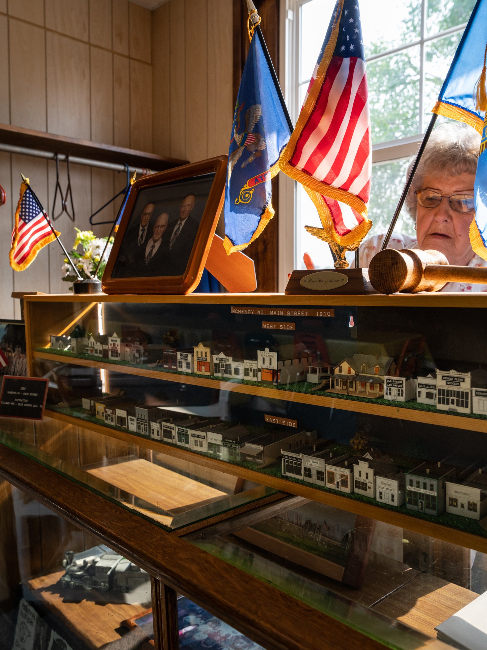
Models of each building that lined the Main Street of McHenry in 1910 are on display at the Senior Center, where Dorothy is fixing the back of the display case.

The Bucks ‘n Does Bar in McHenry

A deer grazing on the lawn of a house in McHenry

Wayne and Rusty working to replace the sidewalk at the Senior Center in McHenry

Sue looking out the window of the Hunting Shack Cafe

The post office in McHenry

Post office boxes in McHenry
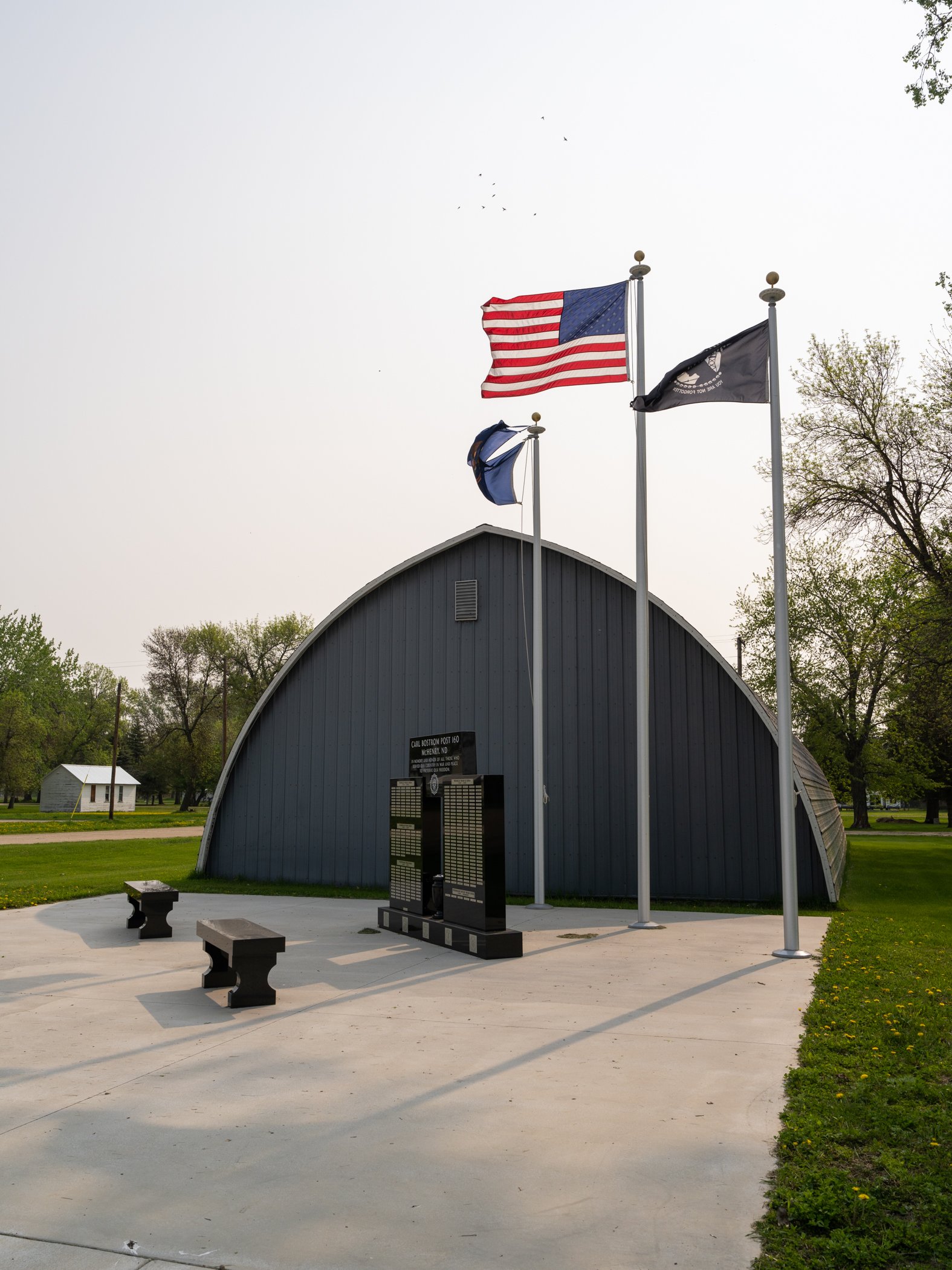
A veteran’s memorial erected by the American Legion’s Carl Bostrom Post 160 in McHenry. The memorial was completed in August of 2022 and dedicated on Memorial Day 2023.
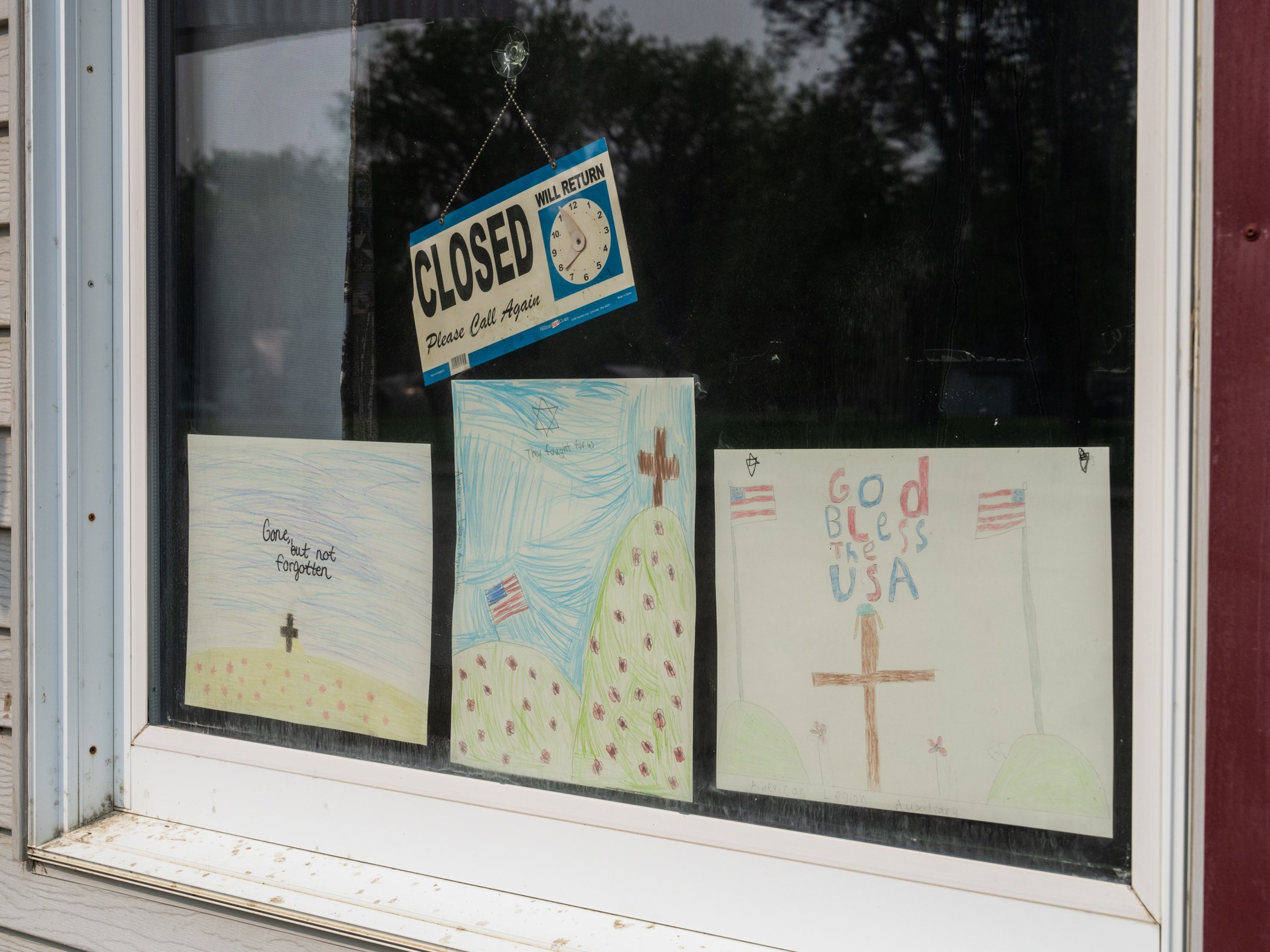
Artwork done by area children for Memorial Day on display in the window of the Hunting Shack Cafe

A tractor passing the ball diamond in McHenry

A pair of Western Grebes in “Lyle’s Lake” east of McHenry

The Hunting Shack Cafe on right and post office on left.
Floyd

I was with my buddy Joel in Atchison, Kansas, working on an upcoming article for the National Railway Historical Society, photographing a railroad swing bridge across the Missouri River that is still in operation. There’s a nice park in town that has a great view of the river and the bridge and is popular with the locals. We had some questions about the bridge and river traffic and thought why not ask someone that looked like they were local? We encountered Floyd.
Each morning Floyd drives into town in his 1977 Ford F-350 he bought new to get coffee and breakfast from McDonald’s. He then comes down to the park to eat and also to feed “his” cats, some strays that live in the park. He then watches any barge or rail traffic that may come by. Floyd has kept pretty busy in his life, spending time in the Navy, traveling to Japan, and even writing plays. He’s never short on ideas.
After breakfast he enjoys smoking his corncob pipe, filled not with traditional pipe tobacco, but with Swisher Sweets cigars he breaks up. He preferred a brand of cigar called Marsh and Wheeling but hasn’t been able to find them locally anymore.
We talked to Floyd about the river, barge traffic, the bridge, and the railroad. He claimed to have had a “five minute railroad career,” it being cut short due to poor eyesight.
After a few hours we parted ways, Floyd returning home to work on whatever project he had in mind that day, us to continue further west into Kansas.
While the meeting with Floyd was brief, it was certainly memorable. You couldn’t meet a friendlier guy!

Pleasant Hill

The road to Jerry’s
In 2016 while working on my Driving Through Flyover Country project I happened upon the small town of Pleasant Hill, Illinois, in Pike County between Quincy and East St. Louis. An old feed store grabbed my attention and I set up my 4x5 to photograph it. While composing under the dark cloth I was a little startled to hear someone shout, “what are you doing?” It was an older fellow in a pickup, so I introduced myself and he said his name was Jerry. He struck up a conversation at was eager to tell me the history of Pike County and Pleasant Hill and show me around. I ended up at his farm and making his portrait and one of his woodworking shop. I later sent him prints, including several of the Springer Feed store I photographed, and he told me to stop by and visit whenever I was in the area. I did so again in 2017 but hadn’t managed to get back again until this spring where I was able to spend the afternoon with Jerry and seeing the sites of Pleasant Hill.

Jerry at home
Pleasant Hill is located at the base of bluffs along the Mississippi River. Before railroads and highways rivers served as primary trade routes, and the Mississippi was a major one. Native Americans used the Mississippi ever since they first encountered it (Jerry has found stone projectile points on his farm that a university estimated to date back to 5000 B.C.E.), and the Europeans quickly made use of the river to access furs and trade. Accordingly Pleasant Hill has a history of European settlement going at least to 1821 when a tavern was erected. Jacob Turnbeaugh was an early settler, coming in 1827; a school was opened in 1832. Eventually the Chicago and Alton Railroad would build a line through town. Pleasant Hill never grew exceptionally large, but did grow to have a substantial number of businesses. The flood plain west of town made for excellent farm land, except for the fact it was a flood plain, and often did flood (more on that later).

The farm site Jerry’s grandparents started
Jerry was a farmer himself in the flood plain. His family bought a farm there in 1880 that they still own. Jerry has retired from farming but still keeps busy with other hobbies such as woodworking (he gifted me a charcuterie board made from lumber found in the barn that already existed when his grandfather bought it in 1880). Aside from farming Jerry was instrumental in building a public pool in town, active in the farmer’s levee system, and generally helping out people in any way he could. There’s even a variety of Oak tree that grew on his farm he sold the cutting rights to for Stark Brother’s Nursery across the river in Louisiana, MO. Jerry’s led a pretty active and fulfilling life!
Jerry demonstrates the difference between red and white oak
Red oak is on the left, white on the right. As he said, you can see why white oak is used in barrel-making!
As stated above being in the Mississippi flood plain means that flooding is going to be a problem. Local farmers took it upon themselves to solve this problem beginning well over 100 years ago by constructing a series of levees to keep the river out. The levee system has been expanded and improved over the years and is funded by the landowners who are protected by the system. In the 1960s they erected a series of pumping stations on creeks flowing into the Mississippi to keep the big river from back-flooding into the creeks. One recently received an upgrade with a two 2000 HP Diesel engines and massive pumps to augment the original station built in the ‘60’s. The system has worked, Jerry’s farmland hasn’t been flooded in over a century. He said 1993 was very close, but the water never crested the levees. If it had his house would’ve been under 12 feet of water.

A truck fuels the diesel storage tanks at the new pump station, one of the levees is seen in the background
I met with Jerry in the morning and he updated me on what was going on around Pleasant Hill and showed me his latest woodworking projects. We then got a tour of the pumping station before heading to town for lunch at Pam’s Cafe.
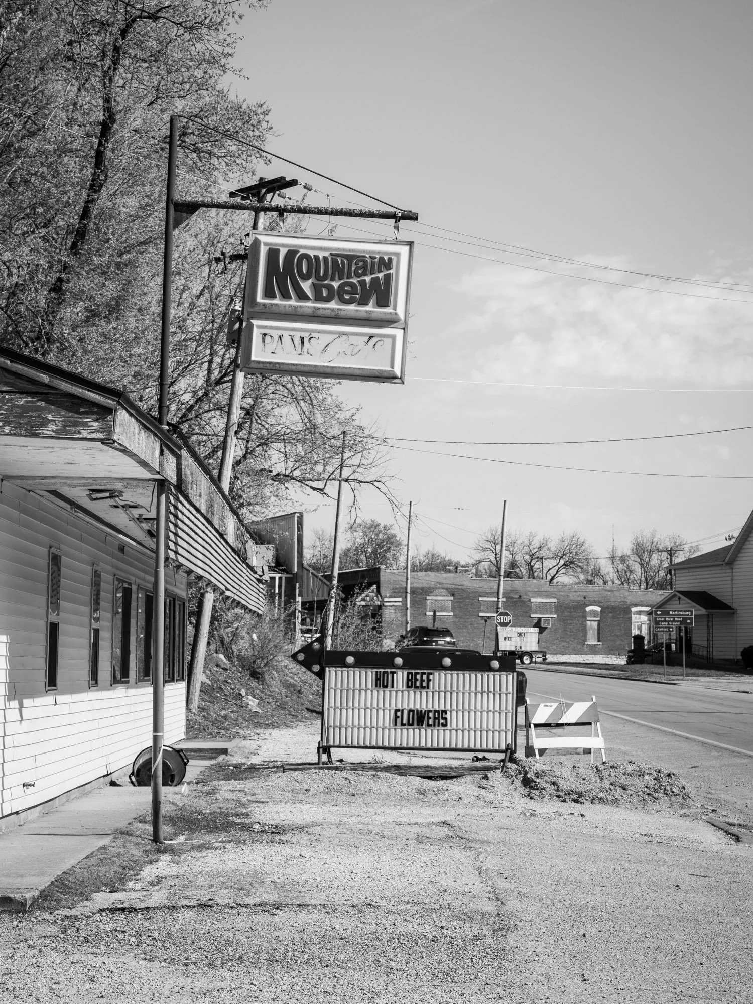
Pam’s Cafe in Pleasant Hill

The lunch crowd at Pam’s
One part of the building is the cafe, the other part is a flower shop

Bobby having lunch at Pam’s

The hat is self-explanatory


After a chicken salad sandwich lunch Jerry continued on the tour of Pleasant Hill. I saw the pool he helped construct, a house built out of stove wood, and an old school building. We ended the visit back at Jerry’s farm where he showed me some more woodworking projects and his supply of lumber that he’s cut locally himself over the decades.

Jerry made this from plans in a magazine in the 1930’s from lumber he cut himself
Even though I was there for well over six hours the time just flew by and I had to get on the road to meet a friend in Atchison, Kansas that night. I bid Jerry farewell with the hopes of coming back to visit again another day! This is an example of how photography can lead you to meet and stay in touch with people you probably wouldn’t otherwise. And while I was happy to get some photos from the visit I enjoyed the visit much more than the photography. A visit with Jerry and people of Pleasant Hill can only be experienced, not captured through a lens.
Wilson, Kansas

A grain elevator complex at Wilson, KS. This elevator appeared in the 1973 film Paper Moon
In 2020 my friend and fellow photographer Joel Jensen came across the small town of Wilson, Kansas, on Google Earth while researching for an upcoming trip to photograph the state. Dropping a pin for a street view the first thing he saw was the elevator complex pictured above with a wonderful Sunflower Coal advertisement printed on it. He also discovered an old railroad hotel there, the Midland Hotel, and suggested it may be an interesting town to visit and spend a night in. In March of 2021 we made our first visit to Wilson and were immediately hooked. I’ve since been there two more times and Joel has been there twice that. Coming to Wilson is like stepping back in time. Many of the buildings in the business district are constructed of native limestone, most of which date back over a century (unfortunately many are currently sitting empty). An old service station serves as the town welcome center. There’s at least two working payphones in town. Spending an evening walking around town it was completely silent and I didn’t run across anyone, despite the fact the town has 859 residents. And then there’s the Midland Railroad Hotel, over 120 years old and refurbished into a gem on the plains.

A still from the 1973 film Paper Moon, the same elevator complex as pictured above. Several scenes were filmed in Wilson and many others filmed in surrounding towns.
Before the railroad there was the Butterfield Overland Despatch wagon trail, which established a stage stop about a half-mile south of present-day Wilson in 1865. The Kansas Pacific Railroad, already built from Kansas City to Salina, acquired status as a land grant railroad from the U.S. government and in 1869 began building west towards Denver. In 1871 the station of Wilson was established (originally it was to be called Bosland) on the railroad, however the town wasn’t incorporated until 1883. The area attracted large numbers of Czech immigrants from Bohemia who started coming to the Wilson area in 1874. Wilson still honors its Czech heritage with a festival each year, the world’s largest Czech egg, and the claim to be the “Czech Capital of Kansas.”

The world’s largest Czech egg. A Czech egg is a painted or embellished egg exchanged at holidays and celebrations between friends and is known as “kraslice” in the Czech culture. The 20 foot egg was commissioned by the city in 2016 and created by local artist Christine Slechta.

The Midland Railroad Hotel in Wilson, originally constructed in 1899 and rebuilt in 1902 after a fire.
The crown jewel of Wilson is the Midland Railroad Hotel. It was originally constructed in 1899 as the Powers Hotel. The hotel was constructed of native limestone three stories tall and located behind the Union Pacific Railroad depot (Union Pacific was the successor to the Kansas Pacific). It catered to travelers on the railroad going between Kansas City and Denver. The original hotel was gutted in a 1902 fire but was rebuilt as the Midland Railroad Hotel, complete with gas lights and other modern-day conveniences. Traveling salesmen frequently used the hotel basement to showcase there wares in what would eventually become known as the “Sample Room,” which today maintains the same name but houses a restaurant and bar. The Midland maintained its status as one of the premier hotels of the region through the 1920s.
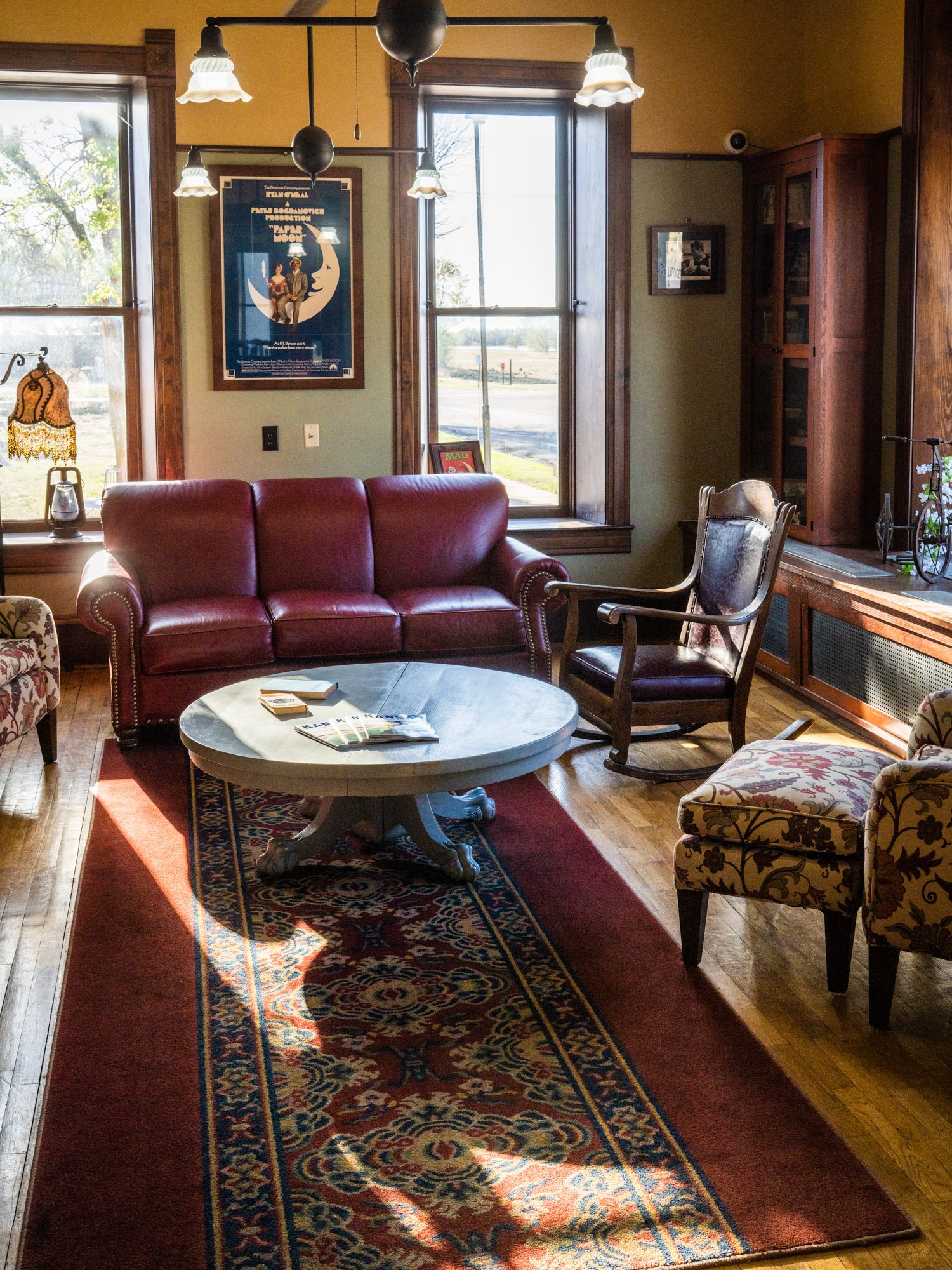
The hotel, like the rest of the world, went through some hard times during the Great Depression. Rooms were often rented out to boarders and the entire third floor was converted into a chicken coop to raise poultry for the restaurant. The hotel survived, however, and continued in operation until 1988. The hotel sat vacant until 1997 when it was purchased for $35,000 by the Wilson Foundation. The hotel underwent a six-year, $3.2 million renovation and re-opened in 2003. The hotel is currently owned by Melinda Merrill, who has roots going way back in the community. She is constantly working to improve on the hotel to offer the best service possible. In 2021 she acquired a barn that had originally sat behind the Midland but had since been moved to a farm and moved it back, converting it into a bar, restaurant, and venue space. The hotel and “The Barn” are once again becoming popular gathering places and even hosting live music occasionally.

Melinda Merrill, owner of the Midland Railroad Hotel and Midland Mercantile
In addition to the hotel Melinda also owns the Midland Mercantile, a store that sells local arts and crafts. The store will soon be moving up the street into another historic building that will undergo renovations with one side holding the mercantile and the other a Czech heritage museum. On the same block the city is also raising funds to save and repurpose the Wilson Opera House. The Opera House was constructed in 1901 with native limestone but was unfortunately gutted by fire in 2009. Rather than rebuild the Opera House the city is planning to stabilize the still-standing walls and transform the interior into an open air amphitheater. It’s a unique approach to saving a building that otherwise probably couldn’t be completely rebuilt.

Limestone, brick, and wood buildings make up Wilson’s business district.

A Wilson resident out for a walk enjoying the pleasant spring weather.

Limestone buildings across the tracks from the Midland Hotel, the Midland Mercantile is located in the building with eggs painted on the windows.
Wilson also had a brush with fame in Peter Bogdanovich’s 1973 film Paper Moon, the town serving as one of the filming locations in the movie. The movie stars Ryan and Tatum O’Neal in a comedy-drama road trip film set in Kansas during the depression. Ryan plays Moses, a con-man that befriends recently orphaned Addie, played by his daughter Tatum, who agrees to take her to relatives in Missouri. The pair are made for each other, running scams across the state while forming their own father-and-daughter-like relationship (albeit a bit strange one!). The film was (and still is) loved by critics and won several awards. Scenes filmed in Wilson include a grain elevator (see above), a gas station (constructed in Wilson specifically for the movie), a scene on Main Street, exteriors of the Midland Hotel, and a few interiors of the Midland (cut together with hotels from neighboring towns). The Midland Hotel is holding a 50th Anniversary party for Paper Moon in May 2023 where people are encouraged to dress in period clothing and attend a screening of the film projected on the side of the hotel.


Wilson also has a cafe, gas station, bank, grocery store, and museum. Just to the north of town is Lake Wilson, boasting the clearest water in Kansas. A wonderful monument to locals lost in The Great War stands in a park in front of the Midland Hotel. Even with these businesses Wilson, like many Great Plains towns, isn’t quite what it used to be. Many of the historic buildings remain empty, and in 2022 one was even blown down by strong winds. But luckily locals are working to preserve what they can, even if Wilson can never reach the heights it once did.

This magnificent building in Wilson was destroyed by strong winds in early 2022. It has since been demolished.

Melinda Merrill watches a passing Union Pacific train from the windows of the Midland Mercantile. The railroad first built through what would become Wilson in 1869.

The Tuttle Community Store

Tuttle is located in Kidder County in central North Dakota. The town is small (60 people in the 2020 census) but the community came together to own and operate a grocery store so the town wouldn’t lose that vital service. Through regular business and donations the Tuttle Community Store has managed to stay open, however their distributor, Henry’s Foods, has decided that they no longer wish to do business with such a small store and will end deliveries on April 1, 2023. The future of the store is unknown, without a distributor there’s no way to stay open.

The Tuttle Community Store


The Town Cafe and grain elevator in Tuttle
Doreen Holm manages the store and has said a Dollar General that opened in Steele, about 20 miles south of Tuttle, has hurt the already struggling store. “If Dollar General offered franchises we’d probably try to do that here, but they own their own stores so that isn’t possible.” Steele also has a dedicated grocery store, otherwise the next nearest store is in Harvey, about 50 miles away, or Bismarck, 60 miles away.


The US Post Office shares the same building as the store

A former food cooler case has been transformed into a little library where community members create their own library by donating books

“Help your store, buy clearance”
The same distributor is also cutting ties with a small store in Hurdsfield, about 20 miles to the north of Tuttle. “We just don’t know what’s going to happen, this may be it,” said Ms. Holm. “They only want the big guys to stay around.”

Heavy snow has pushed a herd of deer into Tuttle where they scavenge for spilled grain around the elevator

The Tuttle Community Store faces an uncertain future. The town held a meeting on March 22 to try and find a solution. Tuttle has already lost its railroad and school, however there is a bright spot in town. The Tuttle Rural Innovation Center bought the closed school and is working to transform it into a community center to house businesses and local craftsmen.

Blizzard

Blizzard in Minot, ND - March 11, 2023
The entire state of North Dakota experienced a blizzard from March 10-12, 2023, though the worst of it occurred on March 11. 7 to 14 inches came down through various parts of the state but the real problem was wind; it was often sustained wind speeds of above 30 mph with gusts up to 50. The result was giant snowdrifts packed hard. It still doesn’t compare in severity to the famous blizzard of March 2-5, 1966, when 20-30 inches fell across the state with wind gusts up to 70 mph creating snowdrifts as hight as 40 feet. While the March blizzard of 2023 (and March isn’t over yet!) was tame compared to 1966 it still essentially shut the state down.

ND DOT employee Bill Koch standing atop a snow drift up to the tops of railroad telegraph poles in the aftermath of the 1966 blizzard.
Photograph by Ernest Feland, collection of the North Dakota State Historical Society
My full time job is working for a railroad, and my employer, wanting to keep trains moving through the blizzard, provided hotel rooms in Minot, ND, so we could make it in to work since numerous roads were blocked with snowdrifts or closed by the state. In the middle of the blizzard I got bored sitting in the hotel room so I went for a walk around the area nearby.
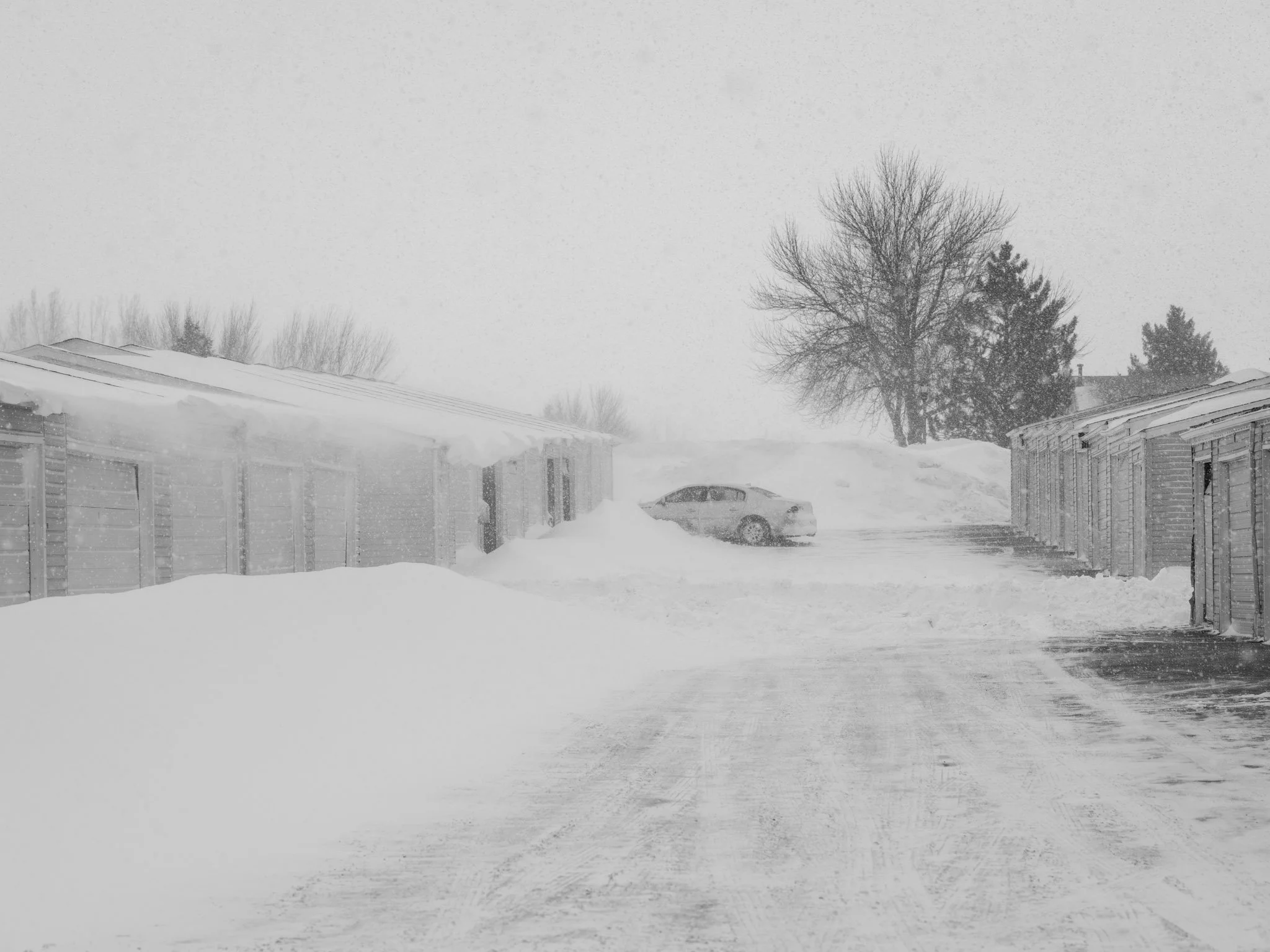
Apartment complex in Minot
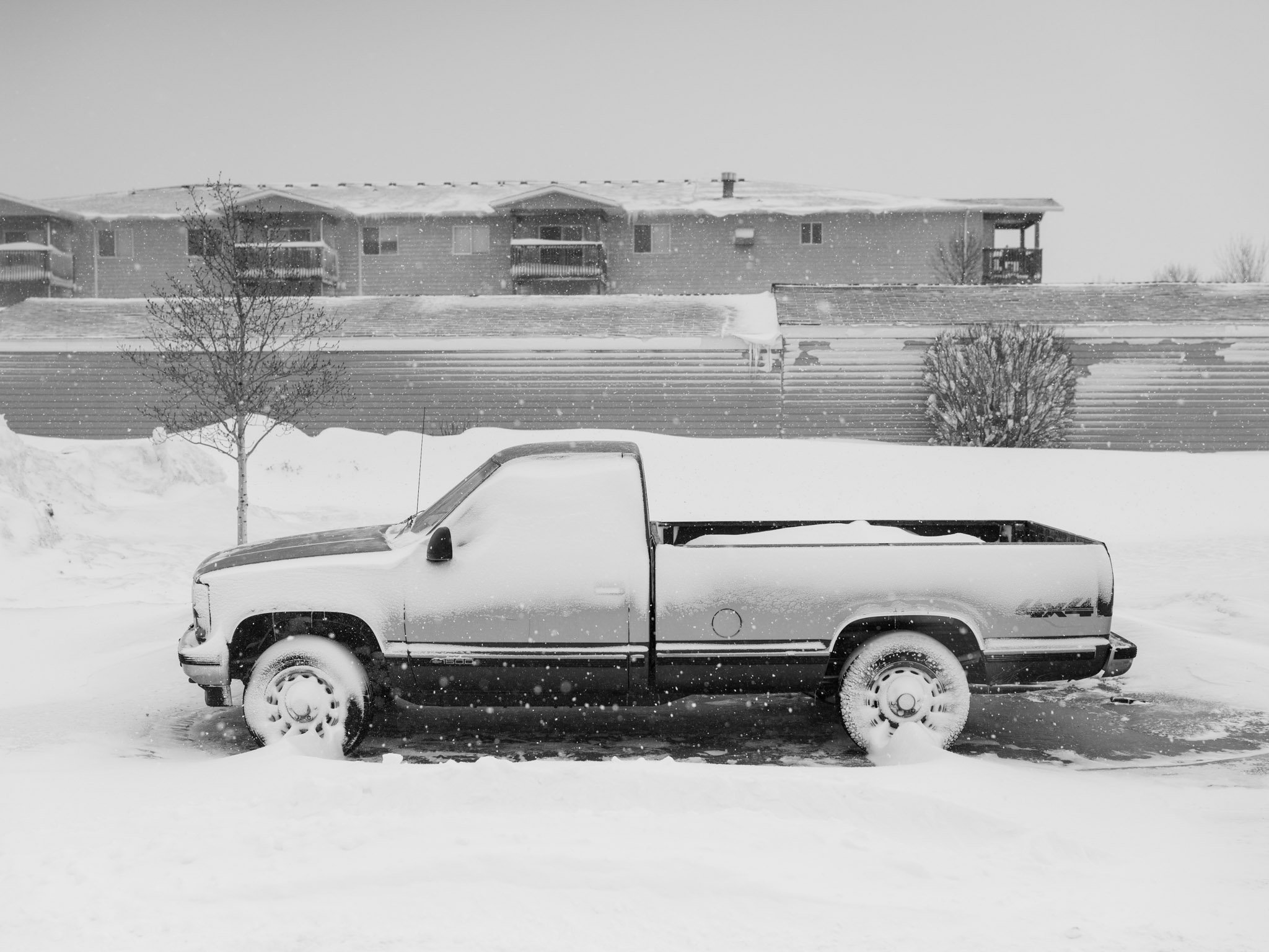
Minot received somewhere around 13 inches of snow. I’m not sure how much had already fallen by the time I was out walking around but it was pretty deep. A few people were already at work cleaning up snow in driveways and parking lots. You’d expect the streets to be deserted but there was still a good amount of traffic driving around. I’m actually surprised just how busy the nearby Scheels sporting goods store was, not even a blizzard can stop American consumerism.

16th Street in Minot

After a few hours of wandering around the snow-filled streets I had enough excitement and went back to the hotel. Several coworkers also stuck at the hotel had a game of pinochle going and I sat in with them. There were plenty of stories heard from other guys who had already been working out in the blizzard, it was much better to be inside playing cards and watching people in two-wheel drive vehicles try to get through the snow-filled parking lot (“If they can’t even get out of the parking lot where do they think they’re going to get out on the streets?”). After three days gone I finally made it home to my own mess of snow, a four foot drift blocking the doors into my house.
North Dakota always seems to generate a big blizzard in March right before the weather breaks towards spring, hopefully this is it! But, there’s still a long time left before spring on the northern Plains…
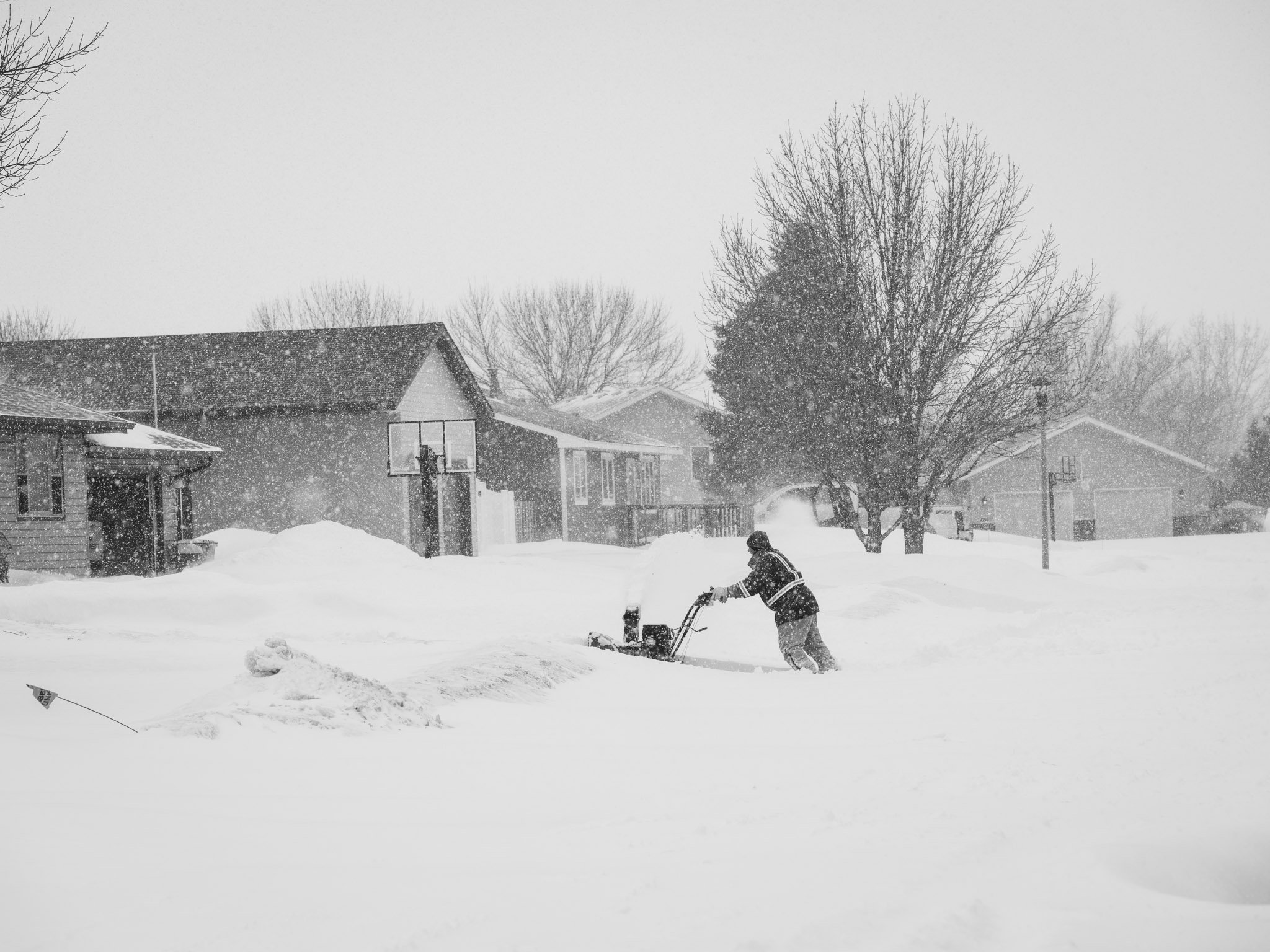
Fighting the good fight in Minot
